Hachita, New Mexico
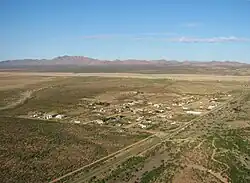
Hachita is a census-designated place in Grant County, New Mexico, United States. Its population was 49 as of the 2010 census. Hachita has a post office with ZIP code 88040.[4][5] New Mexico State Road 9, New Mexico State Road 81, and New Mexico State Road 146 pass through the community. Hachita should not be confused with Old Hachita, which is a ghost town several miles west of town.
Hachita, New Mexico | |
|---|---|
 Hachita | |
 Hachita  Hachita | |
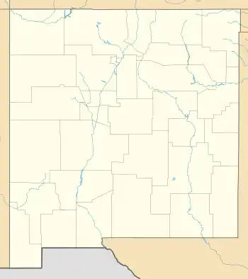
| Coordinates: 31°55′05″N 108°19′13″W | |
| Country | United States |
| State | New Mexico |
| County | Grant |
| Area | |
| • Total | 0.44 sq mi (1.15 km2) |
| • Land | 0.44 sq mi (1.15 km2) |
| • Water | 0.00 sq mi (0.00 km2) |
| Elevation | 4,521 ft (1,378 m) |
| Population | |
| • Total | 52 |
| • Density | 117.38/sq mi (45.30/km2) |
| Time zone | UTC-7 (Mountain (MST)) |
| • Summer (DST) | UTC-6 (MDT) |
| ZIP code | 88040 |
| Area code | 575 |
| GNIS feature ID | 920609[3] |
References
- "ArcGIS REST Services Directory". United States Census Bureau. Retrieved October 12, 2022.
- "Census Population API". United States Census Bureau. Retrieved October 12, 2022.
- "Hachita". Geographic Names Information System. United States Geological Survey, United States Department of the Interior.
- United States Postal Service (2012). "USPS - Look Up a ZIP Code". Retrieved February 15, 2012.
- "Postmaster Finder - Post Offices by ZIP Code". United States Postal Service. Retrieved August 7, 2013.
- "Census of Population and Housing". Census.gov. Retrieved June 4, 2016.
External links
![]() Media related to Hachita, New Mexico at Wikimedia Commons
Media related to Hachita, New Mexico at Wikimedia Commons
Municipalities and communities of Grant County, New Mexico, United States | ||
|---|---|---|
| City | 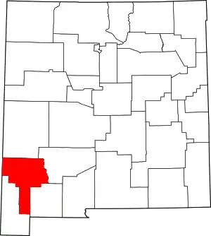 Map of New Mexico highlighting Grant County | |
| Towns | ||
| Village | ||
| CDPs | ||
| Other communities | ||
| Ghost towns | ||
This article is issued from Wikipedia. The text is licensed under Creative Commons - Attribution - Sharealike. Additional terms may apply for the media files.