Faywood, New Mexico
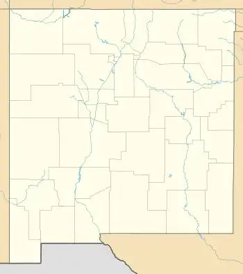
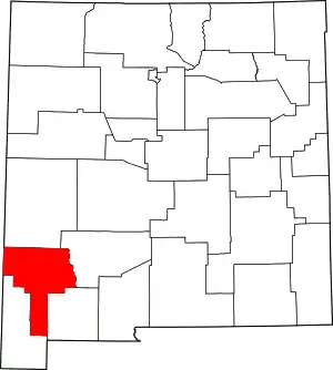
Faywood is a census-designated place in Grant County, New Mexico, United States. Its population was 33 as of the 2010 census. Faywood has a post office with ZIP code 88034.[4] It is located 3 miles (4.8 km) north of US 180 on NM 61.[5]
Faywood, New Mexico | |
|---|---|
 Faywood  Faywood | |
| Coordinates: 32°37′29″N 107°52′21″W | |
| Country | United States |
| State | New Mexico |
| County | Grant |
| Area | |
| • Total | 0.53 sq mi (1.36 km2) |
| • Land | 0.53 sq mi (1.36 km2) |
| • Water | 0.00 sq mi (0.00 km2) |
| Elevation | 5,216 ft (1,590 m) |
| Population | |
| • Total | 33 |
| • Density | 62.74/sq mi (24.24/km2) |
| Time zone | UTC-7 (Mountain (MST)) |
| • Summer (DST) | UTC-6 (MDT) |
| ZIP code | 88034 |
| Area code | 575 |
| GNIS feature ID | 2584099[3] |
History
The area was the site of hot springs which drew visitors from 1859, when a hotel and bath house was built by William Watts. By 1900, the Faywood settlement was created and named for the developers of the Faywood Hot Springs, J.C. Fay, William Lockwood. A third developer was T.C. McDermott. The post office was moved northeast to Dwyer, but is still named the Faywood Post Office.[5]
Climate
Faywood has a cool semi-arid climate (Köppen BSk) with hot summers and mild winters.
| Climate data for Faywood, New Mexico (1991–2020 normals, extremes 1962–2013) | |||||||||||||
|---|---|---|---|---|---|---|---|---|---|---|---|---|---|
| Month | Jan | Feb | Mar | Apr | May | Jun | Jul | Aug | Sep | Oct | Nov | Dec | Year |
| Record high °F (°C) | 79 (26) |
80 (27) |
87 (31) |
92 (33) |
100 (38) |
105 (41) |
104 (40) |
101 (38) |
98 (37) |
93 (34) |
82 (28) |
74 (23) |
105 (41) |
| Mean maximum °F (°C) | 68.2 (20.1) |
72.1 (22.3) |
78.8 (26.0) |
85.0 (29.4) |
93.2 (34.0) |
100.1 (37.8) |
98.9 (37.2) |
95.7 (35.4) |
91.5 (33.1) |
86.6 (30.3) |
76.6 (24.8) |
68.4 (20.2) |
101.1 (38.4) |
| Average high °F (°C) | 56.4 (13.6) |
60.4 (15.8) |
67.8 (19.9) |
75.2 (24.0) |
83.0 (28.3) |
92.3 (33.5) |
90.9 (32.7) |
88.0 (31.1) |
83.9 (28.8) |
76.0 (24.4) |
64.5 (18.1) |
55.9 (13.3) |
74.5 (23.6) |
| Daily mean °F (°C) | 41.9 (5.5) |
44.8 (7.1) |
51.1 (10.6) |
57.3 (14.1) |
64.7 (18.2) |
74.3 (23.5) |
76.1 (24.5) |
74.0 (23.3) |
69.0 (20.6) |
59.8 (15.4) |
49.2 (9.6) |
41.5 (5.3) |
58.6 (14.8) |
| Average low °F (°C) | 27.4 (−2.6) |
29.3 (−1.5) |
34.4 (1.3) |
39.3 (4.1) |
46.4 (8.0) |
56.2 (13.4) |
61.4 (16.3) |
59.9 (15.5) |
54.2 (12.3) |
43.6 (6.4) |
33.8 (1.0) |
27.0 (−2.8) |
42.7 (5.9) |
| Mean minimum °F (°C) | 17.1 (−8.3) |
19.0 (−7.2) |
22.3 (−5.4) |
27.6 (−2.4) |
35.5 (1.9) |
46.8 (8.2) |
55.0 (12.8) |
54.2 (12.3) |
44.3 (6.8) |
30.8 (−0.7) |
21.0 (−6.1) |
14.9 (−9.5) |
12.9 (−10.6) |
| Record low °F (°C) | 3 (−16) |
−2 (−19) |
3 (−16) |
17 (−8) |
23 (−5) |
35 (2) |
44 (7) |
40 (4) |
30 (−1) |
18 (−8) |
8 (−13) |
0 (−18) |
−2 (−19) |
| Average precipitation inches (mm) | 0.94 (24) |
0.74 (19) |
0.31 (7.9) |
0.25 (6.4) |
0.37 (9.4) |
0.74 (19) |
2.55 (65) |
2.71 (69) |
1.63 (41) |
1.08 (27) |
0.69 (18) |
0.87 (22) |
12.88 (327) |
| Average snowfall inches (cm) | 0.3 (0.76) |
0.3 (0.76) |
0.0 (0.0) |
0.0 (0.0) |
0.0 (0.0) |
0.0 (0.0) |
0.0 (0.0) |
0.0 (0.0) |
0.0 (0.0) |
0.0 (0.0) |
0.0 (0.0) |
1.2 (3.0) |
1.8 (4.52) |
| Average precipitation days (≥ 0.01 inch) | 3.4 | 3.7 | 2.1 | 1.2 | 1.3 | 2.5 | 8.7 | 8.9 | 4.4 | 4.3 | 2.3 | 3.7 | 46.5 |
| Average snowy days (≥ 0.1 in) | 0.2 | 0.1 | 0.0 | 0.0 | 0.0 | 0.0 | 0.0 | 0.0 | 0.0 | 0.0 | 0.0 | 0.3 | 0.6 |
| Source: NOAA (snow/snow days 1981–2010)[7][8][9] | |||||||||||||
See also
- City of Rocks State Park
- Faywood Hot Springs
- NAN Ranch, National Register of Historic Places
- NAN Ranch Ruin, archaeological site
- Swarts Ruin, Mimbres culture archaeological site
References
- "ArcGIS REST Services Directory". United States Census Bureau. Retrieved October 12, 2022.
- "Census Population API". United States Census Bureau. Retrieved October 12, 2022.
- "Faywood Census Designated Place". Geographic Names Information System. United States Geological Survey, United States Department of the Interior.
- United States Postal Service (2012). "USPS - Look Up a ZIP Code". Retrieved February 15, 2012.
- Robert Hixson Julyan (January 1, 1996). The Place Names of New Mexico. UNM Press. p. 130. ISBN 978-0-8263-1689-9.
- "Census of Population and Housing". Census.gov. Retrieved June 4, 2016.
- "NOWData - NOAA Online Weather Data". National Oceanic and Atmospheric Administration. Retrieved August 10, 2022.
- "U.S. Climate Normals Quick Access – Station: Faywood, NM (1991–2020)". National Oceanic and Atmospheric Administration. Retrieved February 16, 2023.
- "U.S. Climate Normals Quick Access – Station: Faywood, NM (1981–2010)". National Oceanic and Atmospheric Administration. Retrieved February 16, 2023.
This article is issued from Wikipedia. The text is licensed under Creative Commons - Attribution - Sharealike. Additional terms may apply for the media files.
