Goyder Highway
Goyder Highway (B64) is a west–east link through the Mid North region of South Australia connecting Spencer Gulf to the Riverland. It is part of the most direct road route from Port Augusta (and areas beyond including Eyre Peninsula, Western Australia and the Northern Territory) to much of Victoria and southern New South Wales.
Goyder Highway | |
|---|---|
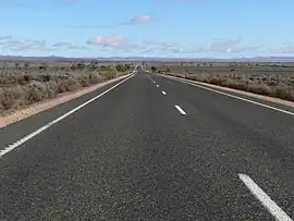 | |
| Goyder Highway northwest of Morgan | |
 West end East end | |
| Coordinates |
|
| General information | |
| Type | Highway |
| Length | 266 km (165 mi)[1] |
| Route number(s) | |
| Former route number | |
| Major junctions | |
| West end | Crystal Brook, South Australia |
| East end | Monash, South Australia |
| Location(s) | |
| Region | Yorke and Mid North, Murray and Mallee[2] |
| Major settlements | Crystal Brook, Spalding, Burra, Morgan |
| Highway system | |
History
Goyder Highway is named after George Goyder, a government surveyor who first identified and mapped Goyder's Line which indicates the northern limit of climatic suitability for intensive agriculture in South Australia. Goyder's Line is near the highway from Crystal Brook to past Burra.
Route
Goyder Highway starts from the Augusta Highway at Crystal Brook running east then southeast. It is briefly concurrent with Horrocks Highway near Gulnare, RM Williams Way near Spalding and Barrier Highway near Burra.[3] The highway descends from the Mount Lofty Ranges onto the plains of the Murray–Darling basin. It passes the end of Thiele Highway at Morgan and continues upstream on the north side of the Murray River to meet Sturt Highway between Barmera and Monash.[3]
Major intersections
| LGA[4] | Location[1][3] | km[1] | mi | Destinations | Notes |
|---|---|---|---|---|---|
| Port Pirie | Crystal Brook | 0.0 | 0.0 | Western terminus of highway and route B64 | |
| 4.0 | 2.5 | Cunningham Street (northeast) – Crystal Brook Eyre Road (southeast), to Huddleston Road – Gladstone | Cross road | ||
| 4.5 | 2.8 | Gadd Avenue (Venning Road) (southwest) – Merriton Darbon Terrance (Frith Road) (northwest) – Crystal Brook | Cross road | ||
| Northern Areas | Gulnare | 29 | 18 | Concurrency with route B82 | |
| 31 | 19 | ||||
| Spalding | 47 | 29 | Concurrency with route B80 | ||
| 52 | 32 | ||||
| Goyder | Burra | 86 | 53 | Concurrency with route A32 | |
| 93 | 58 | ||||
| Worlds End | 111 | 69 | Worlds End Highway – Robertstown, Eudunda | ||
| Mid Murray | Morgan | 177 | 110 | Tee junction | |
| Stuart | 187 | 116 | Cadell Valley Road – Cadell | ||
| Loxton Waikerie | Taylorville | 210 | 130 | Taylorville Road – Waikerie | |
| Berri Barmera | Barmera | 253 | 157 | Morgan Road – Barmera | |
| Monash | 266 | 165 | Eastern terminus of highway and route B64 | ||
| |||||
References
- Google (2 June 2022). "Wilkins Highway" (Map). Google Maps. Google. Retrieved 2 June 2022.
- "Location SA Map viewer with regional layers". Government of South Australia. Retrieved 16 June 2022.
- "Location SA Map viewer with suburb layers". Government of South Australia. Retrieved 16 June 2022.
- "Location SA Map viewer with LGA layers". Government of South Australia. Retrieved 16 June 2022.
Road infrastructure in South Australia | ||
|---|---|---|
| Expressways |
| |
| Interstate highways | ||
| State highways | ||
| Arterial roads |
| |
| Outback tracks | ||