Gouézec
Gouézec (French pronunciation: [ɡwezɛk]; Breton: Gouezeg) is a commune in the Finistère department of Brittany in north-western France.
Gouézec
Gouezeg | |
|---|---|
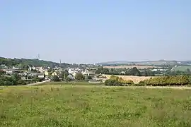 A general view of Gouézec | |
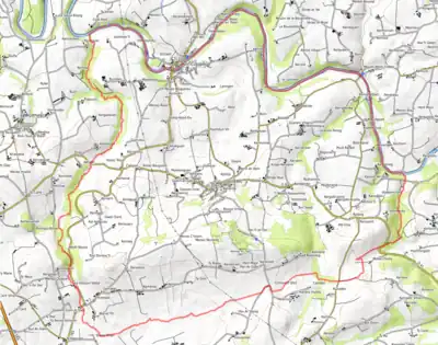
Location of Gouézec | |
 Gouézec  Gouézec | |
| Coordinates: 48°10′12″N 3°58′15″W | |
| Country | France |
| Region | Brittany |
| Department | Finistère |
| Arrondissement | Châteaulin |
| Canton | Briec |
| Intercommunality | Pleyben-Châteaulin-Porzay |
| Government | |
| • Mayor (2020–2026) | Cécile Nay[1] |
| Area 1 | 30.94 km2 (11.95 sq mi) |
| Population | 1,104 |
| • Density | 36/km2 (92/sq mi) |
| Time zone | UTC+01:00 (CET) |
| • Summer (DST) | UTC+02:00 (CEST) |
| INSEE/Postal code | 29062 /29190 |
| Elevation | 19–270 m (62–886 ft) |
| 1 French Land Register data, which excludes lakes, ponds, glaciers > 1 km2 (0.386 sq mi or 247 acres) and river estuaries. | |
Population
Inhabitants of Gouézec are called in French Gouézécois.
|
|
| ||||||||||||||||||||||||||||||||||||||||||||||||||||||||||||||||||||||||||||||||||||||||||||||||||||||||||||||||||
Geography
The river Aulne forms the commune's northern border. The Kareg an Tan (270 meters above sea level) is the highest peak in the village.
Map
See also
References
- "Répertoire national des élus: les maires" (in French). data.gouv.fr, Plateforme ouverte des données publiques françaises. 13 September 2022.
- "Populations légales 2020". The National Institute of Statistics and Economic Studies. 29 December 2022.
External links
Wikimedia Commons has media related to Gouézec.
- Base Mérimée: Search for heritage in the commune, Ministère français de la Culture. (in French)
- Mayors of Finistère Association (in French)
This article is issued from Wikipedia. The text is licensed under Creative Commons - Attribution - Sharealike. Additional terms may apply for the media files.