Geesbrug
Geesbrug is a village in the Netherlands and is part of the Coevorden municipality in Drenthe.
Geesbrug | |
|---|---|
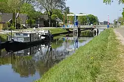
 Bridge at Geesbrug | |
 Geesbrug  Geesbrug | |
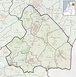
| Coordinates: 52°43′40″N 6°38′2″E | |
| Country | Netherlands |
| Province | Drenthe |
| Municipality | Coevorden |
| Area | |
| • Total | 19.01 km2 (7.34 sq mi) |
| Elevation | 15 m (49 ft) |
| Population (2021)[1] | |
| • Total | 1,355 |
| • Density | 71/km2 (180/sq mi) |
| Time zone | UTC+1 (CET) |
| • Summer (DST) | UTC+2 (CEST) |
| Postal code | 7917[1] |
| Dialing code | 0524 |
Geesburg was first mentioned in 1913, and means the bridge near Gees.[3]
Work Camp Geesburg
Work Camp Geesburg was built in the 1930s for the unemployed.[4] In 1942, it was used as a Jewish forced labour camp to cultivate the land. They were later moved to Westerbork transit camp.[5]
In 1949, Indonesia became independent, and the Royal Netherlands East Indies Army was disbanded. The islands of Ambon, Buru, and Seram had fought on side of the Netherlands, and proclaimed the Republic of South Maluku which resulted in an attack by Indonesia. In 1951, 12,000 refugees from South Maluku were temporarily resettled in the Netherlands.[6] A group of refugees was resetlled in Camp Geesbrug. The camp is nowadays in use as a pig farm.[7]
References
- "Kerncijfers wijken en buurten 2021". Central Bureau of Statistics. Retrieved 13 March 2022.
Two entries
- "Postcodetool for 7917TA". Actueel Hoogtebestand Nederland (in Dutch). Het Waterschapshuis. Retrieved 12 March 2022.
- "Geesbrug - (geografische naam)". Etymologiebank (in Dutch). Retrieved 13 March 2022.
- "Werkkamp Geesbrug". Joods Amsterdam (in Dutch). Retrieved 13 March 2022.
- "Geesbrug". Plaatsengids (in Dutch). Retrieved 13 March 2022.
- J.H.W. Veenstra (1978). "Ambon, een blok aan Nederlands been". Ons Erfdeel (in Dutch). pp. 511–512. Retrieved 13 March 2022.
- Marjolijn Kok. "Geesbrug achter het hek". Moluks Erfgoed (in Dutch). Retrieved 13 March 2022.