Funing County, Jiangsu
Funing County (simplified Chinese: 阜宁县; traditional Chinese: 阜寧縣; pinyin: Fùníng Xiàn) is under the administration of Yancheng, Jiangsu province, China. The county borders the prefecture-level city of Huai'an to the west. It has a population of 1.08 million, with 180,000 in the urban area, and a jurisdiction area of 1,436 km2. It is under the jurisdiction of Yancheng municipality. The county was incorporated in 1731. Its seat of government is located at Fucheng Town. Funing is a 400-km drive from Shanghai via the G15 Expressway.
Funing
阜宁县 Fowning | |
|---|---|
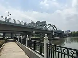 Funing County in January 2016 | |
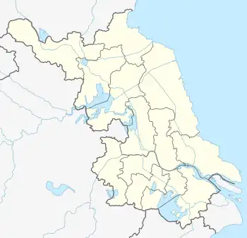 Funing Location in Jiangsu | |
| Coordinates: 33°41′13″N 119°43′44″E[1] | |
| Country | People's Republic of China |
| Province | Jiangsu |
| Prefecture-level city | Yancheng |
| Area | |
| • Total | 1,439 km2 (556 sq mi) |
| Population | |
| • Total | 825,400 |
| • Density | 570/km2 (1,500/sq mi) |
| Time zone | UTC+8 (China Standard) |
| Area code | 224400 |
Funing is famous for being a revolutionary area of the Chinese Communist Party.
It is also home to the Jiangsu Funing Economic Development Zone.
Administrative divisions
At present, Funing County has 20 towns.[2]
- 20 towns
|
|
Climate
| Climate data for Funing (1991–2020 normals, extremes 1981–2010) | |||||||||||||
|---|---|---|---|---|---|---|---|---|---|---|---|---|---|
| Month | Jan | Feb | Mar | Apr | May | Jun | Jul | Aug | Sep | Oct | Nov | Dec | Year |
| Record high °C (°F) | 19.2 (66.6) |
25.2 (77.4) |
26.7 (80.1) |
32.3 (90.1) |
35.6 (96.1) |
37.2 (99.0) |
37.7 (99.9) |
37.3 (99.1) |
35.3 (95.5) |
31.3 (88.3) |
28.0 (82.4) |
20.0 (68.0) |
37.7 (99.9) |
| Average high °C (°F) | 6.1 (43.0) |
8.6 (47.5) |
13.6 (56.5) |
20.0 (68.0) |
25.3 (77.5) |
28.8 (83.8) |
31.0 (87.8) |
30.5 (86.9) |
26.9 (80.4) |
22.1 (71.8) |
15.4 (59.7) |
8.6 (47.5) |
19.7 (67.5) |
| Daily mean °C (°F) | 1.5 (34.7) |
3.6 (38.5) |
8.2 (46.8) |
14.2 (57.6) |
19.8 (67.6) |
23.9 (75.0) |
27.1 (80.8) |
26.6 (79.9) |
22.3 (72.1) |
16.7 (62.1) |
10.2 (50.4) |
3.8 (38.8) |
14.8 (58.7) |
| Average low °C (°F) | −1.9 (28.6) |
−0.1 (31.8) |
3.9 (39.0) |
9.4 (48.9) |
15.1 (59.2) |
20.0 (68.0) |
24.2 (75.6) |
23.7 (74.7) |
18.9 (66.0) |
12.6 (54.7) |
6.3 (43.3) |
0.2 (32.4) |
11.0 (51.9) |
| Record low °C (°F) | −11.8 (10.8) |
−12.7 (9.1) |
−7.8 (18.0) |
−1.1 (30.0) |
4.8 (40.6) |
12.0 (53.6) |
17.8 (64.0) |
16.0 (60.8) |
9.9 (49.8) |
1.2 (34.2) |
−6.0 (21.2) |
−11.5 (11.3) |
−12.7 (9.1) |
| Average precipitation mm (inches) | 25.3 (1.00) |
29.9 (1.18) |
45.0 (1.77) |
46.5 (1.83) |
69.4 (2.73) |
134.1 (5.28) |
206.0 (8.11) |
197.4 (7.77) |
82.0 (3.23) |
42.9 (1.69) |
45.3 (1.78) |
24.4 (0.96) |
948.2 (37.33) |
| Average precipitation days (≥ 0.1 mm) | 5.4 | 6.7 | 7.5 | 7.2 | 9.1 | 9.0 | 12.7 | 12.1 | 8.3 | 6.6 | 6.7 | 5.0 | 96.3 |
| Average snowy days | 2.4 | 2.2 | 0.8 | 0 | 0 | 0 | 0 | 0 | 0 | 0 | 0.5 | 0.8 | 6.7 |
| Average relative humidity (%) | 72 | 72 | 71 | 70 | 73 | 77 | 83 | 85 | 82 | 76 | 75 | 72 | 76 |
| Mean monthly sunshine hours | 146.1 | 145.9 | 179.1 | 200.5 | 207.5 | 170.2 | 168.1 | 183.4 | 175.6 | 179.7 | 152.5 | 151.2 | 2,059.8 |
| Percent possible sunshine | 46 | 47 | 48 | 51 | 48 | 40 | 39 | 45 | 48 | 52 | 49 | 49 | 47 |
| Source: China Meteorological Administration[3][4] | |||||||||||||
See also
References
- Google (2014-07-02). "Funing" (Map). Google Maps. Google. Retrieved 2014-07-02.
- "盐城市-行政区划网 www.xzqh.org" (in Chinese). XZQH. Retrieved 2012-05-24.
- 中国气象数据网 – WeatherBk Data (in Simplified Chinese). China Meteorological Administration. Retrieved 25 June 2023.
- 中国气象数据网 (in Simplified Chinese). China Meteorological Administration. Retrieved 25 June 2023.
External links
- Funing Government website
- Funing County English guide (Jiangsu.net)
This article is issued from Wikipedia. The text is licensed under Creative Commons - Attribution - Sharealike. Additional terms may apply for the media files.