Forni di Sotto
Forni di Sotto (Fornes: For Disot) is a comune (municipality) in the Regional decentralization entity of Udine in the Italian region of Friuli-Venezia Giulia, located about 120 kilometres (75 mi) northwest of Trieste and about 60 kilometres (37 mi) northwest of Udine. As of 31 December 2004, it had a population of 701 and an area of 93.0 square kilometres (35.9 sq mi).[3]
Forni di Sotto
| |
|---|---|
| Comune di Forni di Sotto | |
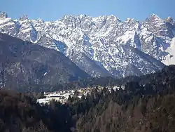 Forni di Sotto in winter | |
Location of Forni di Sotto | |
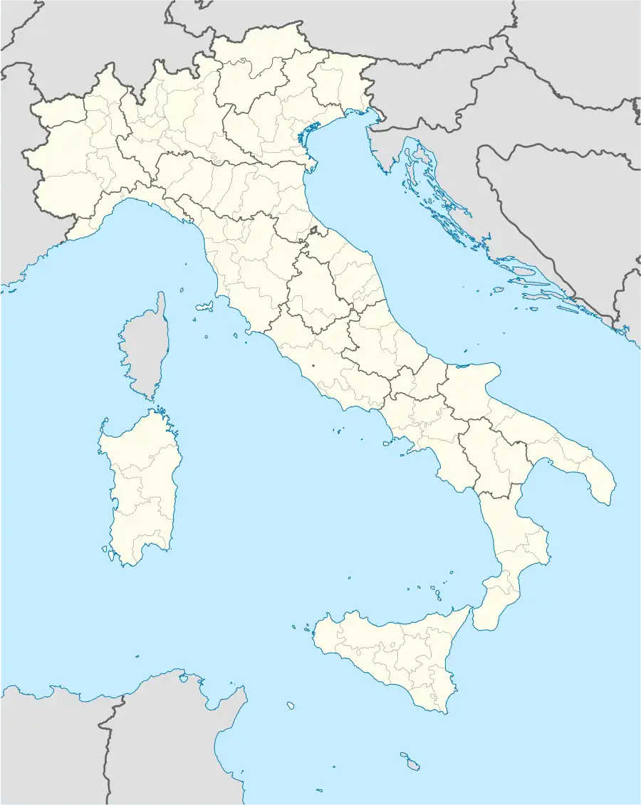 Forni di Sotto Location of Forni di Sotto in Italy  Forni di Sotto Forni di Sotto (Friuli-Venezia Giulia) | |
| Coordinates: 46°24′N 12°40′E | |
| Country | Italy |
| Region | Friuli-Venezia Giulia |
| Province | Udine (UD) |
| Area | |
| • Total | 93.0 km2 (35.9 sq mi) |
| Population (Dec. 2004)[2] | |
| • Total | 701 |
| • Density | 7.5/km2 (20/sq mi) |
| Demonym | Fornesi |
| Time zone | UTC+1 (CET) |
| • Summer (DST) | UTC+2 (CEST) |
| Postal code | 33020 |
| Dialing code | 0433 |
| Website | Official website |
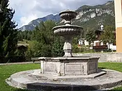
One of three nineteenth-century fountains
Forni di Sotto borders the following municipalities: Ampezzo, Claut, Forni di Sopra, Sauris, Socchieve, Tramonti di Sopra.
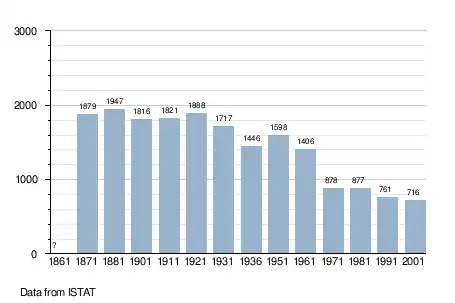
Demographic evolution
References
- "Superficie di Comuni Province e Regioni italiane al 9 ottobre 2011". Italian National Institute of Statistics. Retrieved 16 March 2019.
- "Popolazione Residente al 1° Gennaio 2018". Italian National Institute of Statistics. Retrieved 16 March 2019.
- All demographics and other statistics: Italian statistical institute Istat.
External links

This article is issued from Wikipedia. The text is licensed under Creative Commons - Attribution - Sharealike. Additional terms may apply for the media files.