Esfarayen County
Esfarayen County (Persian: شهرستان اسفراین) is in North Khorasan province, Iran. Its capital is the city of Esfarayen.
Esfarayen County
Persian: شهرستان اسفراین | |
|---|---|
County | |
.svg.png.webp) Location of Esfarayen County in North Khorasan province | |
 Location of North Khorasan province in Iran | |
| Coordinates: 36°57′N 57°31′E[1] | |
| Country | Iran |
| Province | North Khorasan |
| Capital | Esfarayen |
| Districts | Central, Bam and Safiabad |
| Population (2016)[2] | |
| • Total | 120,513 |
| Time zone | UTC+3:30 (IRST) |
| Esfarayen County at GEOnet Names Server | |
At the 2006 census, the county's population was 119,152 in 30,307 households.[3] The following census in 2011 counted 127,012 people in 35,903 households.[4] At the 2016 census, the county's population was 120,513 in 36,519 households.[2]
The surrounding mountains and deserts have become totally Kurdish and Turkmen in their ethnicity and language. It was only Esfarayen that resisted the flood of violence that swept away the ancient and sedentary Persian-speaking farmers and townsfolk of northern Khorasan, starting with the Mongol invasion, the coming of destructive tribes, and finally the massive murder and depopulation of northern Khorasan in the 18th and 19th centuries by the hands of Turkmen raiders and slave catchers.
Khorasani Persians were found in great numbers at the slave markets of Khiva and Kashgar in China in the late 19th century, being sold by the Turkmens. Esfarayen preserves what the entire northwestern Khorasan (including the whole southern half of Turkmenistan) must have looked like before the avalanche of the Turkic nomadic invasion began in the 11th century.
Administrative divisions
The population history of Esfarayen County's administrative divisions over three consecutive censuses is shown in the following table. The latest census shows two districts, seven rural districts, and two cities.[2]
| Administrative Divisions | 2006[3] | 2011[4] | 2016[2] |
|---|---|---|---|
| Central District | 99,381 | 107,743 | 103,603 |
| Azari Rural District | 13,596 | 14,762 | 14,203 |
| Daman Kuh Rural District | 7,887 | 7,641 | 7,252 |
| Milanlu Rural District | 3,936 | 3,293 | 3,904 |
| Ruin Rural District | 15,810 | 15,266 | 14,135 |
| Zorqabad Rural District | 6,831 | 6,409 | 4,619 |
| Esfarayen (city) | 51,321 | 60,372 | 59,490 |
| Bam and Safiabad District | 19,771 | 19,133 | 16,887 |
| Bam Rural District | 9,041 | 7,888 | 6,902 |
| Safiabad Rural District | 7,683 | 7,718 | 6,558 |
| Safiabad (city) | 3,047 | 3,527 | 3,427 |
| Total | 119,152 | 127,012 | 120,513 |
References
- OpenStreetMap contributors (17 May 2023). "Esfarayen County" (Map). OpenStreetMap. Retrieved 17 May 2023.
- "Census of the Islamic Republic of Iran, 1395 (2016)". AMAR (in Persian). The Statistical Center of Iran. p. 28. Archived from the original (Excel) on 27 October 2020. Retrieved 19 December 2022.
- "Census of the Islamic Republic of Iran, 1385 (2006)". AMAR (in Persian). The Statistical Center of Iran. p. 28. Archived from the original (Excel) on 20 September 2011. Retrieved 25 September 2022.
- "Census of the Islamic Republic of Iran, 1390 (2011)" (Excel). Iran Data Portal (in Persian). The Statistical Center of Iran. p. 28. Retrieved 19 December 2022.
| Capital | 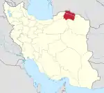 | ||||||||||||||
|---|---|---|---|---|---|---|---|---|---|---|---|---|---|---|---|
| Counties and cities |
| ||||||||||||||
| Sights |
| ||||||||||||||
| populated places | |||||||||||||||