Egglescliffe
Egglescliffe is a village and civil parish in County Durham, England.[1] Administratively it is located in the borough of Stockton-on-Tees.[2]
| Egglescliffe | |
|---|---|
| Village and civil parish | |
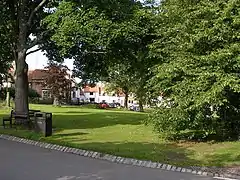 Egglescliffe green | |
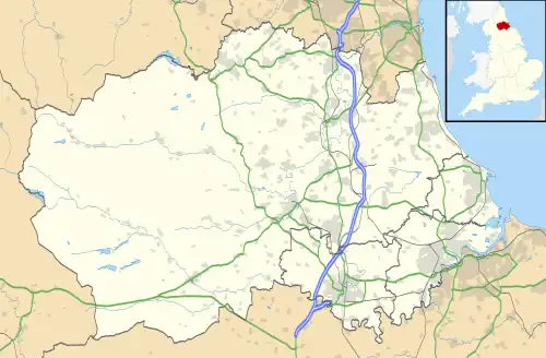 Egglescliffe Location within County Durham | |
| Population | 8,559 (2011) |
| OS grid reference | NZ421131 |
| Civil parish |
|
| Unitary authority | |
| Ceremonial county | |
| Region | |
| Country | England |
| Sovereign state | United Kingdom |
| Post town | STOCKTON-ON-TEES |
| Postcode district | TS16 |
| Dialling code | 01642 |
| Police | Cleveland |
| Fire | Cleveland |
| Ambulance | North East |
| UK Parliament | |
The civil parish is in the Teesdale with a population of 8,559 at the 2011 Census.[3] In the 2021 census the group of interconnected villages in the parish and Preston-on-Tees had a population of 10,250, in the larger village to small town classification.[4] It is has Egglescliffe School (secondary and sixth-form), an light industrial estate, two railway stations and golf club. Villages in the parish include Eaglescliffe, Urlay Nook, Sunningdale, Orchard and a development on the former Allens West MOD site.[5]
The village is on top of a hill with the River Tees at the bottom, overlooking Yarm on the other bank. It had a 2001 population of around 595,[6] There is a Church of England primary school, small kids play area, farms, allotments and a public house (called the Pot and Glass).
History

North of the River Tees was not recorded in the 1068 Domesday Book. The parish church is dedicated to St John the Baptist and there has been a place of worship on the site since the twelfth century.
Bishop Skirlaw of Durham built a stone bridge, across the Tees in 1400 which still stands. An iron replacement was built in 1805, but it fell down in 1806.[7]
Governance
It was in the palatinate of Durham (the prince-bishop of Durham's domain) from its establishment until 1836 when it became a standard type of county. 1974 reforms lead to Egglescliffe being placed under the Stockton district of Cleveland county. The district became a unitary authority in 1996 and a part of the ceremony county Durham.
Etymology
The second element of Egglescliffe is from Old English clif, 'steep slope'. The first element has been etymologised as Latin ecclesia 'church' or the form it took when borrowed into Cumbric, represented today by Welsh eglwys. However, the first element could also be from an Anglo-Saxon personal name like Ecgi or Ecgel, in which case the name means 'Ecgel's steep slope'.[8]
Geography
Egglescliffe parish villages | ||||||||||||||||
|---|---|---|---|---|---|---|---|---|---|---|---|---|---|---|---|---|
| ||||||||||||||||
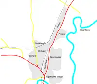
The parish is divided by railway lines, such as the Tees Valley line and Northallerton–Eaglescliffe line. Vehicles can only get from the east to west of the parish to its far south or via the A66 road.
The parish includes the villages of Egglescliffe, Eaglescliffe, Sunningdale and Orchard. Urlay Nook and the former Allens West site are in development. They is also an industrial estate which includes the former Whitley Springs farm buildings.
The main road through eastern parish is the A135 Yarm Road which was part of the old route of the A19 until the 1970s when it was diverted east of Thornaby. The A67 runs through the west of the parish. Nearby large towns include Stockton-on-Tees (north), Middlesbrough (north east), Darlington (west) and Hartlepool (north east).
Gallery
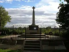 War memorial
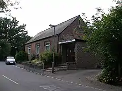 Parish hall
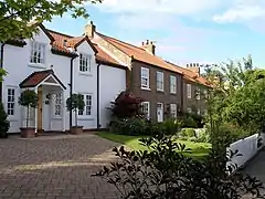 Church Road cottages
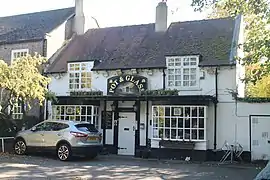 Pot & Glass public house
See also
References
- County Durham, England's Cities, Towns, Villages and Settlements
- Councils in Stockton-on-Tees, County Durham - Yahoo! Local UK
- "Civil Parish population 2011". Retrieved 24 July 2015.
- "Towns and cities, characteristics of built-up areas, England and Wales: Census 2021". Retrieved 3 August 2021.
- "History of the Parish". www.egglescliffeandeaglescliffe-pc.org.uk. Egglescliffe & Eaglescliffe Parish Council. Retrieved 26 August 2021.
- "Area Snapshot". Archived from the original on 27 September 2007. Retrieved 21 June 2007.
- Historic England. "Yarm Bridge Over River Tees (1105658)". National Heritage List for England. Retrieved 13 September 2021.
- Bethany Fox, 'The P-Celtic Place-Names of North-East England and South-East Scotland', The Heroic Age, 10 (2007), http://www.heroicage.org/issues/10/fox.html (appendix at http://www.heroicage.org/issues/10/fox-appendix.html).
External links
![]() Media related to Egglescliffe at Wikimedia Commons
Media related to Egglescliffe at Wikimedia Commons
The borough of Stockton-on-Tees | |||||||
|---|---|---|---|---|---|---|---|
| Major Settlements | |||||||
| Villages | |||||||
| Governance |
| ||||||
| Culture, leisure and tourism | |||||||
| Services |
| ||||||
| Organisations |
| ||||||
| Sport | |||||||
| Waterways | |||||||
| Transport |
| ||||||
| Historic | |||||||
| Other |
| ||||||