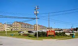
Eeyou Istchee James Bay
Eeyou Istchee James Bay (French: Eeyou Istchee Baie-James, Cree: ᐄᔨᔨᐤ ᐊᔅᒌ ᒉᐃᒥᔅ ᐯᐃ iiyiyiw aychii cheimiy pei) is a local municipality in the Jamésie (TE) in administrative region of Nord-du-Québec. Located to the east of James Bay, Eeyou Istchee James Bay covers 283,123.42 km2 (109,314.56 sq mi) of land, making it the largest incorporated municipality in Canada — only eight unorganized territories are larger.[3] Its territory covers almost entirely the Equivalent territory of Jamésie.
Eeyou Istchee James Bay
Eeyou Istchee Baie-James ᐄᔨᔨᐤ ᐊᔅᒌ ᒉᐃᒥᔅ ᐯᐃ | |
|---|---|
 | |
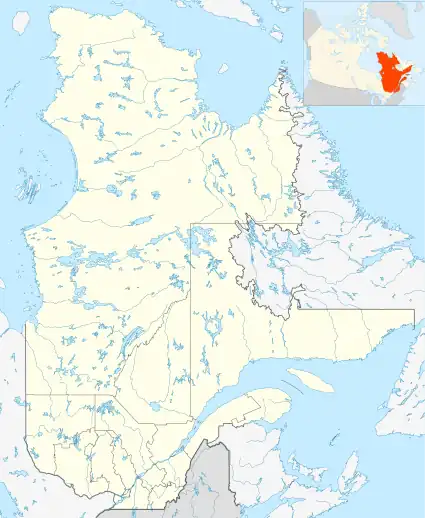
 Eeyou Istchee James Bay Location in Quebec  Eeyou Istchee James Bay Eeyou Istchee James Bay (Canada) | |
| Coordinates: 49°45′23″N 77°37′49″W[1] | |
| Country | Canada |
| Province | Quebec |
| Region | Nord-du-Québec |
| Equivalent territory | Jamésie |
| Constituted | July 14, 1971 |
| Government | |
| • Type | Regional government |
| • Mayor | Mandy Gull |
| • Federal riding | Abitibi—Baie-James—Nunavik—Eeyou |
| • Prov. riding | Ungava |
| Area | |
| • Total | 274,623.30 km2 (106,032.65 sq mi) |
| • Land | 283,123.42 km2 (109,314.56 sq mi) |
| There is an apparent contradiction between two authoritative sources | |
| Population (2021)[3] | |
| • Total | 2,638 |
| • Density | 0/km2 (0/sq mi) |
| • Pop (2016–21) | |
| • Dwellings | 1,331 |
| Time zone | UTC−05:00 (EST) |
| • Summer (DST) | UTC−04:00 (EDT) |
| Postal code | |
| Area code | 819 |
The hydroelectric power plants of the La Grande Complex are all located within the municipal boundaries of Eeyou Istchee James Bay, making the municipality strategically important to Quebec's energy policy. Other important economic sectors are mining, softwood logging, forestry, and tourism.
History
The municipality was created in 1971 and was run by the board of directors of the Société de développement de la Baie James. It managed the territory of the James Bay and Northern Quebec Agreement between the 49th and 55th parallel, with the exception of the Cree Category 1 lands and the enclaves of Chapais, Chibougamau, Lebel-sur-Quévillon and Matagami.
In December 2001, the municipal council was reformed. It became a municipality of a special type directed by the mayors of the four enclave towns, as well as the chairpersons of the local community councils of Radisson, Valcanton and Villebois. An eighth seat was reserved for a representative coming from the non-urban territory. The municipality gained additional authority and could exert certain powers as a regional county.
On July 24, 2012, the Quebec government signed an accord with the Cree (Agreement on Governance in the Eeyou Istchee James Bay Territory between the Crees of Eeyou Istchee and the Gouvernement du Québec) which resulted in the replacement of the municipality of Baie-James by the municipality of Eeyou Istchee James Bay.[4] The agreement came into force on January 1, 2014, and is designed to give the Cree expanded powers over lands and resources outside of the Cree municipalities and associated reserved land. The new government consist of Cree and Baie-James residents each having an equal number of votes within the Eeyou Istchee James Bay Regional Government.[5]
Geography
Eeyou Istchee James Bay, extends from the eastern shore of James Bay to the Otish Mountains of the Laurentian Plateau, its mainly composed of the boreal forest. The municipality comprises all lands of Jamésie (TE) minus the four municipalities of Chibougamau, Lebel-sur-Quévillon, Chapais, and Matagami. However, the territory includes four unconstituted localities (localités):
- Radisson
- Valcanton
- Val-Paradis
- Villebois
Demographics
| 2021 | 2016 | 2011 | |
|---|---|---|---|
| Population | 2,638 (+67.1% from 2016) | 1,589 (21.9% from 2011) | 1,303 (-6.5% from 2006) |
| Land area | 283,123.42 km2 (109,314.56 sq mi) | 297,355.46 km2 (114,809.58 sq mi) | 297,332.84 km2 (114,800.85 sq mi) |
| Population density | 0/km2 (0/sq mi) | 0.0/km2 (0/sq mi) | 0.0/km2 (0/sq mi) |
| Median age | 34.4 (M: 33.2, F: 35.6) | 42.5 (M: 42.5, F: 42.5) | 44.8 (M: 45.6, F: 43.4) |
| Private dwellings | 1,331 (total) 906 (occupied) | 903 (total) | 701 (total) |
| Median household income | $91,000 | $62,528 | $61,770 |
|
| ||||||||||||||||||||||||||||||||||||
| Source: Statistics Canada[10][11] | |||||||||||||||||||||||||||||||||||||
The language statistics are as follows (as of the 2021 Census):[3] 48% of Eeyou Istchee James Bay speak French as their first language, 9% speak English as their first language, 0.2% speak both French and English as a first language and 34% have a different first language
Government
Composition & local governance
The territory outside the enclaved Cree communities (Category III lands) is governed by the Eeyou Istchee James Bay Regional Government (le Gouvernement régional d’Eeyou Istchee Baie-James).[12] Local governance is carried out by way of the council of regional government, which for its first ten years is to be composed of 11 Cree representatives, 11 Jamésien representatives, and one non-voting representative of the government of Québec.[13] The Cree representatives consist of the Grand Chief of the Cree Nation Government and then ten members appointed by the Board of the Cree Nation Government from within its own ranks. The Jamésien representatives consist of members of the local municipal councils of Chapais, Chibougamau, Lebel-sur-Quévillon, and Matagami as well as non-Crees in the Eeyout Istchee James Bay Territory and are appointed by the provincial Minister of Municipal Affairs, Regions and Land Occupancy.[13] Finally, the non-voting representative of the government of Quebec is appointed by the Deputy Minister of the Ministère des Affaires municipales, des Régions et de l’Occupation du territoire (MAMROT) from amongst its staff.
Provincial & federal representation
Eeyou Istchee James Bay forms part of the federal electoral district of Abitibi—Baie-James—Nunavik—Eeyou and has been represented by Sylvie Bérubé of the Bloc Québécois since 2019. Provincially, Eeyou Istchee James Bay is part of the Ungava electoral district and is represented by Denis Lamothe of the Coalition Avenir Québec since 2018.
| Year | Liberal | Conservative | Bloc Québécois | New Democratic | Green | ||||||
|---|---|---|---|---|---|---|---|---|---|---|---|
| 2021 | 20% | 164 | 17% | 138 | 49% | 410 | 5% | 44 | 2% | 14 | |
| 2019 | 19% | 188 | 18% | 178 | 51% | 490 | 6% | 60 | 2% | 24 | |
| Year | CAQ | Liberal | QC solidaire | Parti Québécois | |||||
|---|---|---|---|---|---|---|---|---|---|
| 2018 | 40% | 372 | 8% | 76 | 16% | 146 | 24% | 222 | |
| 2014 | 16% | 202 | 24% | 292 | 3% | 42 | 50% | 616 | |
Infrastructure

The primary roads to and within Baie-James are:
- Route 109 - provincial highway to Matagami
- Route 113 - provincial highway from Val-d'Or to Chibougamau
- Route 393 - regional highway to Val-Paradis
- James Bay Road - road from Matagami to Radisson
- North Road
- Trans-Taiga Road - access road to hydro-electric stations of the James Bay Project
Air transportation is through the La Grande Rivière Airport near Radisson, which provides scheduled air service to Montreal and Puvirnituq.
References
- "Reference number 424971 in Banque de noms de lieux du Québec". toponymie.gouv.qc.ca (in French). Commission de toponymie du Québec.
- "Geographic code 99060 in the official Répertoire des municipalités". www.mamh.gouv.qc.ca (in French). Ministère des Affaires municipales et de l'Habitation.
- "2021 Community Profiles". 2021 Canadian Census. Statistics Canada. February 4, 2022. Retrieved 2023-10-19.
- Lia Lévesque (24 July 2012). "Québec et les Cris signent une entente pour un gouvernement régional". La Presse. La Presse Canadienne. Retrieved 2012-07-24.
- "Governance". GREIBJ-EIJBRG. Retrieved 7 December 2017.
- "2016 Community Profiles". 2016 Canadian Census. Statistics Canada. August 12, 2021. Retrieved 2023-06-01.
- "2011 Community Profiles". 2011 Canadian Census. Statistics Canada. March 21, 2019. Retrieved 2014-01-28.
- "2006 Community Profiles". 2006 Canadian Census. Statistics Canada. August 20, 2019.
- "2001 Community Profiles". 2001 Canadian Census. Statistics Canada. July 18, 2021.
- 1996, 2001, 2006, 2011 census
- Statistics Canada - Population and dwelling count amendments to the 2001 Census
- "Territory". GREIBJ-EIJBRG. Retrieved 7 December 2017.
- "Composition". GREIBJ-EIJBRG. Retrieved 7 December 2017.
- "Official Voting Results Raw Data (poll by poll results in Eeyou Istchee James Bay)". Elections Canada. Retrieved March 4, 2023.
- "Official Voting Results by polling station (poll by poll results in Eeyou Istchee James Bay)". Elections Québec. Retrieved March 4, 2023.