Claira
Claira (French pronunciation: [klɛʁa] ⓘ; Catalan: Clairà) is a commune in the Pyrénées-Orientales department in southern France.[3]
Claira
Clairà | |
|---|---|
 The church of Saint-Vincent, in Claira | |
 Coat of arms | |
Location of Claira | |
 Claira  Claira | |
| Coordinates: 42°45′40″N 2°57′22″E | |
| Country | France |
| Region | Occitania |
| Department | Pyrénées-Orientales |
| Arrondissement | Perpignan |
| Canton | La Côte Salanquaise |
| Intercommunality | Corbières Salanque Méditerranée |
| Government | |
| • Mayor (2020–2026) | Marc Petit[1] |
| Area 1 | 19.34 km2 (7.47 sq mi) |
| Population | 4,550 |
| • Density | 240/km2 (610/sq mi) |
| Time zone | UTC+01:00 (CET) |
| • Summer (DST) | UTC+02:00 (CEST) |
| INSEE/Postal code | 66050 /66530 |
| Elevation | 5–20 m (16–66 ft) (avg. 10 m or 33 ft) |
| 1 French Land Register data, which excludes lakes, ponds, glaciers > 1 km2 (0.386 sq mi or 247 acres) and river estuaries. | |
Geography
Claira is located in the canton of La Côte Salanquaise and in the arrondissement of Perpignan.
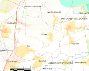
Map of Claira and its surrounding communes
Claira is located 5 km from Perpignan.
Population
| Year | Pop. | ±% p.a. |
|---|---|---|
| 1968 | 1,446 | — |
| 1975 | 1,249 | −2.07% |
| 1982 | 1,415 | +1.80% |
| 1990 | 2,117 | +5.16% |
| 1999 | 2,625 | +2.42% |
| 2007 | 3,469 | +3.55% |
| 2012 | 3,756 | +1.60% |
| 2017 | 4,181 | +2.17% |
| Source: INSEE[4] | ||
References
- "Répertoire national des élus: les maires" (in French). data.gouv.fr, Plateforme ouverte des données publiques françaises. 13 September 2022.
- "Populations légales 2020". The National Institute of Statistics and Economic Studies. 29 December 2022.
- INSEE commune file
- Population en historique depuis 1968, INSEE
External links
 Media related to Claira at Wikimedia Commons
- Histoire du Roussillon (French)
Places adjacent to Claira | |
|---|---|
This article is issued from Wikipedia. The text is licensed under Creative Commons - Attribution - Sharealike. Additional terms may apply for the media files.