Champcevinel
Champcevinel (French pronunciation: [ʃɑ̃səvinɛl]; Occitan: Champsavineu) is a commune in the Dordogne department in Nouvelle-Aquitaine in southwestern France.
Champcevinel | |
|---|---|
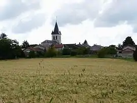
 A general view of Champcevinel | |
 Coat of arms | |
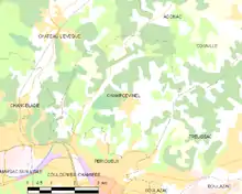
Location of Champcevinel | |
 Champcevinel  Champcevinel | |
| Coordinates: 45°12′56″N 0°43′38″E | |
| Country | France |
| Region | Nouvelle-Aquitaine |
| Department | Dordogne |
| Arrondissement | Périgueux |
| Canton | Trélissac |
| Intercommunality | Le Grand Périgueux |
| Government | |
| • Mayor (2020–2026) | Christian Lecomte[1] |
| Area 1 | 17.72 km2 (6.84 sq mi) |
| Population | 2,980 |
| • Density | 170/km2 (440/sq mi) |
| Time zone | UTC+01:00 (CET) |
| • Summer (DST) | UTC+02:00 (CEST) |
| INSEE/Postal code | 24098 /24750 |
| Elevation | 86–237 m (282–778 ft) (avg. 190 m or 620 ft) |
| 1 French Land Register data, which excludes lakes, ponds, glaciers > 1 km2 (0.386 sq mi or 247 acres) and river estuaries. | |
Geography
Generalities
Being part of the urban unit of Périgueux, Champcevinel is located at the north of the main city. It's 4 km far from the city centre of Périgueux.
Champcevinel makes the immediate suburb of Périgueux, at north between the Routes Départementales 3 and 8.
Adjacent communes

Champcevinel is adjacent to five others communes. At the west of the commune, the territory of Chancelade is less than 300 meters far.
Geology and topography
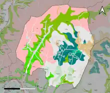
Located in north of Aquitaine Basin and bordered by a part of the Massif Central, the Dordogne department shows a big diversity of geology. The terrains are disposed in depth in regular stratums, causing a sediment on this old marine platform.

Population
|
| |||||||||||||||||||||||||||||||||||||||||||||||||||||||||||||||||||||||||||||||||||||||||||||||||||||||||||||||
| Source: EHESS[3] and INSEE (1968-2017)[4] | ||||||||||||||||||||||||||||||||||||||||||||||||||||||||||||||||||||||||||||||||||||||||||||||||||||||||||||||||
See also
References
- "Répertoire national des élus: les maires". data.gouv.fr, Plateforme ouverte des données publiques françaises (in French). 2 December 2020.
- "Populations légales 2020". The National Institute of Statistics and Economic Studies. 29 December 2022.
- Des villages de Cassini aux communes d'aujourd'hui: Commune data sheet Champcevinel, EHESS (in French).
- Population en historique depuis 1968, INSEE