Benlettery
Benlettery (Irish: Binn Leitrí, meaning 'Peak of the Wet Hillsides')[2] at 557 metres (1,827 ft), is the 259th–highest peak in Ireland on the Arderin scale.[3][4][5] Benlettery is in the southernmost peak of the Twelve Bens mountain range in the Connemara National Park in County Galway, Ireland, and is the 11th-tallest of the core Twelve Bens.[5][6] The Ben Lettery An Oige youth hostel is on the southern slopes of Benlettery, off the N59 road to Clifden.[7][8]
| Benlettery | |
|---|---|
| Binn Leitrí | |
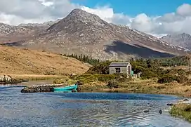 Benlettery behind the Ballynahinch Castle fishery | |
| Highest point | |
| Elevation | 577 m (1,893 ft)[1] |
| Prominence | 62 m (203 ft)[1] |
| Listing | Arderin |
| Coordinates | 53°28′55″N 9°50′43″W[1] |
| Naming | |
| English translation | Peak of the Wet Hillsides |
| Language of name | Irish |
| Geography | |
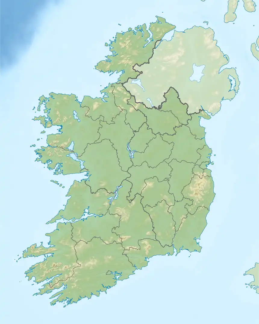 Benlettery Ireland | |
| Location | County Galway, Ireland |
| Parent range | Twelve Bens |
| OSI/OSNI grid | L7754649537 |
| Topo map | OSi Discovery 44 |
| Geology | |
| Type of rock | Pale quartzites, grits, graphitic bedrock[1] |
Naming
According to Irish academic Paul Tempan, the townland of Lettery (Irish: Leitrí, meaning "wet hillsides") is on the south slope of Benlettery.[2] Tempan notes an alternative name of Bindowglass or "Bendouglas" (Irish: Binn Dúghlais, meaning "peak of the black stream") was recorded as early as 1684 by Irish historian Ruaidhrí Ó Flaithbheartaigh.[2] Ó Flaithbheartaigh chronicled about a pool of water on the summit which turns the hair white of anyone who washes in it.[2]
Geography
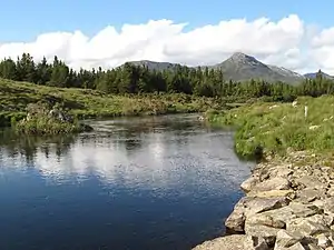
Benlettery is the southernmost peak of the Twelve Bens and lies at its western edge. Benlettery is connected to the range by a high northerly ridge to the peak of Bengower 664 metres (2,178 ft);[5] this ridge forms a fork which also connects neighboring Benglenisky 516 metres (1,693 ft) to Bengower.[5][9] Benlettery is one of the six Bens that form a horseshoe around the valley of the Glencoaghan River (also known as the Glencoaghan Horseshoe).[10][11]
Unlike most of the other main Bens, Benlettery is below 600-metres in elevation, however, its relative positioning at the southern end of the range, and its "pyramidal" summit (when viewed from the south), means that is often featured as a scenic backdrop to the Ballynahinch Castle and the Ballynahinch Lake.[12]
Ben Lettery Connemara Youth Hostel
On the southern slopes of Benlettery is the 40-bed "Ben Lettery Connemara Youth Hostel" (Benlettery spelt as two words), owned and operated by An Oige, the Irish YHA;[7][8] it was ranked by Outside.ie as one of the ten best An Oige youth hostels in Ireland.[13]
Hill walking
As with Derryclare 677 metres (2,221 ft), on the east side of the Glencoaghan Horseshoe, Benlettery's accessibility makes is a popular peak as a standalone 5-kilometre 2-3 hour climb (starting and ending at the Ben Lettery An Oige youth hostel); however, the high ridge Benlettery shares with the peaks of Bengower and Benglenisky, means that it is also climbed as part a 7-kilometre 3-4 hour horseshoe loop-walk with these peaks.[12][14][15]
Benlettery is part of the 16–kilometre 8–9 hour Glencoaghan Horseshoe, considered one of Ireland's best hill-walks;[10][11] and of the even longer Owenglin Horseshoe, a 20–kilometre 10–12 hour route around the Owenglin River taking in over twelve summits.[9]
Gallery
.jpg.webp) Benlettery behind Ballynahinch Castle
Benlettery behind Ballynahinch Castle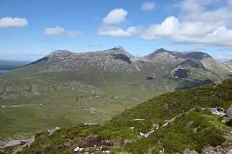
 Benlettery (right) and Benglenisky (left), from the Owenmore River
_and_Benglenisky_(right)_from_Bengower.jpg.webp) Benlettery (left) and Benglenisky (right) from summit of Bengower
Benlettery (left) and Benglenisky (right) from summit of Bengower
Bibliography
- Fairbairn, Helen (2014). Ireland's Best Walks: A Walking Guide. Collins Press. ISBN 978-1848892118.
- MountainViews Online Database (Simon Stewart) (2013). A Guide to Ireland's Mountain Summits: The Vandeleur-Lynams & the Arderins. Collins Books. ISBN 978-1-84889-164-7.
- Paul Phelan (2011). Connemara & Mayo - A Walking Guide: Mountain, Coastal & Island Walks. Collins Press. ISBN 978-1848891029.
- Dillion, Paddy (2001). Connemara: Collins Rambler's guide. Harper Collins. ISBN 978-0002201216.
- Dillion, Paddy (1993). The Mountains of Ireland: A Guide to Walking the Summits. Cicerone. ISBN 978-1852841102.
See also
- Twelve Bens
- Mweelrea, major range in Killary Harbour
- Maumturks, major range in Connemara
- Lists of mountains in Ireland
- Lists of mountains and hills in the British Isles
References
- "Benlettery". MountainViews Online Database. Retrieved 31 July 2019.
- Paul Tempan (February 2012). "Irish Hill and Mountain Names" (PDF). MountainViews.ie.
- Simon Stewart (October 2018). "Arderins: Irish mountains of 500+m with a prominence of 30m". MountainViews Online Database.
- Simon Stewart (October 2018). "Vandeleur-Lynams: Irish mountains of 600+m with a prominence of 15m". MountainViews Online Database.
- Mountainviews, (September 2013), "A Guide to Ireland's Mountain Summits: The Vandeleur-Lynams & the Arderins", Collins Books, Cork, ISBN 978-1-84889-164-7
- Dillion, Paddy (2001). Connemara: Collins Rambler's guide. Harper Collins. ISBN 978-0002201216.
- "Ben Lettery Youth Hostel". An Oige, Irish Youth Hostel Association. Retrieved 9 August 2019.
- "Ben Lettery Hostel". Lonely Planet. Retrieved 9 August 2019.
- Dillion, Paddy (2001). Connemara: Collins Rambler's guide. Harper Collins. ISBN 978-0002201216.
Walk 24: Owenglin Horseshoe
- Helen Fairbairn (30 December 2014). Ireland's Best Walks: A Walking Guide (Walking Guides). Collins Press. ISBN 978-1848892118.
ROUTE 34: The Glencoaghan Horseshoe. A true classic
- Dillion, Paddy (2001). Connemara: Collins Rambler's guide. Harper Collins. ISBN 978-0002201216.
Walk 30: Gleann Chóchan Horseshoe
- Dillion, Paddy (2001). Connemara: Collins Rambler's guide. Harper Collins. ISBN 978-0002201216.
Walk 23: Binn Ghleann Uisce
- "10 Awesome An Óige Hostels". Outside.ie. Retrieved 9 August 2019.
- John G. O'Dwyer (29 October 2015). "A walk for the weekend: Twelve Bens, Connemara, Co Galway". Irish Times. Retrieved 9 August 2019.
- Paul Phelan (2011). Connemara & Mayo - A Walking Guide: Mountain, Coastal & Island Walks. Collins Press. ISBN 978-1848891029.
Route 4: Benglenisky, Bengower and Benlettery
External links
- MountainViews: The Irish Mountain Website, Benlettery
- MountainViews: Irish Online Mountain Database
- The Database of British and Irish Hills , the largest database of British Isles mountains ("DoBIH")
- Hill Bagging UK & Ireland, the searchable interface for the DoBIH
| British Isles | 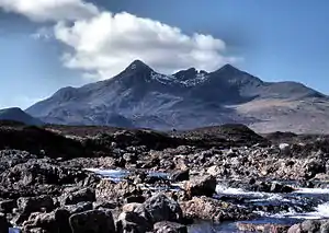 | |
|---|---|---|
| Scotland | ||
| Outside Scotland | ||
| England | ||
| Ireland | ||
| County tops | ||
Mountains and hills of Connacht | |||||||
|---|---|---|---|---|---|---|---|
| Achill Island | 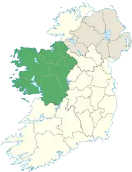 | ||||||
| Dartry Mountains | |||||||
| Maumturks | |||||||
| Mweelrea Mountains | |||||||
| Nephin Range | |||||||
| Ox Mountains | |||||||
| Partry Mountains | |||||||
| Sheeffry Range | |||||||
| Benna Beola |
| ||||||
| Others | |||||||
.jpg.webp)