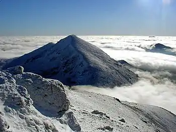
Ben Vorlich, Loch Lomond
Ben Vorlich (Scottish Gaelic: Beinn Mhùrlaig)[2] is a mountain in the Arrochar Alps of Argyll, in the Southern Highlands of Scotland. It reaches 943 metres (3,094 ft), making it a Munro. It lies between Loch Lomond and Loch Sloy. Ben Vorlich is the highest point of the historic county of Dunbartonshire.
| Ben Vorlich | |
|---|---|
| Beinn Mhùrlaig | |
_-_geograph.org.uk_-_1456731.jpg.webp) Ben Vorlich from the south | |
| Highest point | |
| Elevation | 943 m (3,094 ft)[1] |
| Prominence | 632 m (2,073 ft) |
| Parent peak | Beinn Ìme |
| Listing | Munro, Marilyn, County top (Dunbartonshire) |
| Naming | |
| Language of name | Gaelic |
| Pronunciation | Gaelic [peɲ ˈvuːrˠl̪ˠɛkʲ] ⓘ |
| Geography | |
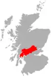
| Location | Arrochar Alps, Argyll, Scotland |
| Parent range | Arrochar Alps, Grampian Mountains |
| OS grid | NN295124 |
| Topo map | OS Landranger 56 |
The A82 road and the West Highland railway line run on the eastern side of Ben Vorlich, above the shoreline of Loch Lomond.
The peak forms a north–south ridge on the western side of Loch Lomond, with a subsidiary ridge known as Little Hills running from the summit east down to the shores of the loch. There are three small summits around 800 m apart along the main ridge; the central one is the highest, though the southern one has a trig point.

References
- "walkhighlands Ben Vorlich (Loch Lomond)". walkhighlands.co.uk. 2013. Retrieved 16 October 2013.
- "Ben Vorlich, Loch Lomond". Ainmean-Àite na h-Alba: Gaelic Place-Names of Scotland.
 |  | ||
| Northern Highlands (20) |  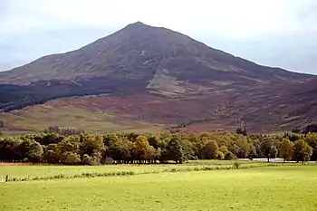 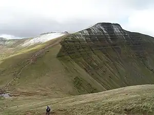 | |
|---|---|---|
| Western Highlands (20) | ||
| Central and Eastern Highlands (13) | ||
| Southern Highlands (15) | ||
| Islands (13) | ||
| Scottish Lowlands, England and Wales (13) | ||
| Republic of Ireland, Northern Ireland (25) | ||