Bandar Abbas County
Bandar Abbas County (Persian: شهرستان بندرعباس) is in Hormozgan province, Iran. Its capital is the city of Bandar Abbas.[3]
Bandar Abbas County
Persian: شهرستان بندرعباس | |
|---|---|
County | |
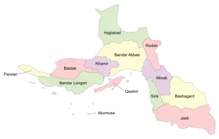
 Location of Bandar Abbas County in Hormozgan province (center, yellow) | |
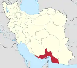
 Location of Hormozgan province in Iran | |
| Coordinates: 27°30′N 56°14′E[1] | |
| Country | |
| Province | Hormozgan |
| Capital | Bandar Abbas |
| Districts | Central, Fin, Hormuz, Qaleh Qazi, Shamil, Takht |
| Population (2016)[2] | |
| • Total | 680,366 |
| Time zone | UTC+3:30 (IRST) |
At the 2006 census, the county's population was 498,644 in 119,485 households.[4] The following census in 2011 counted 588,288 people in 158,677 households.[5] At the 2016 census, the county's population was 680,366 in 196,220 households.[2]
Administrative divisions
The population history and structural changes of Bandar Abbas County's administrative divisions over three consecutive censuses are shown in the following table. The latest census shows four districts, 11 rural districts, and five cities.[2]
After the 2016 census, Hormuz District was transferred from Qeshm County to Bandar Abbas County.[6] Shamil District was established and divided into two rural districts, including the newly formed Hasan Langi Rural District.[7] Jalabi Rural District was established within Takht District.[7]
| Administrative Divisions | 2006[4] | 2011[5] | 2016[2] |
|---|---|---|---|
| Central District | 429,093 | 525,042 | 614,599 |
| Gachin RD | 19,479 | 20,741 | 18,960 |
| Isin RD | 20,735 | 26,529 | 27,243 |
| Sarkhun RD | 6,287 | 7,548 | |
| Siyahu RD | 10,184 | 8,927 | |
| Tazian RD | 21,371 | 25,550 | 21,010 |
| Bandar Abbas (city) | 367,508 | 435,751 | 526,648 |
| Tazian-e Pain (city) | 4,263 | ||
| Fin District | 23,514 | 17,043 | 16,359 |
| Fin RD | 9,277 | 9,865 | 10,415 |
| Gohreh RD | 2,363 | 1,899 | 2,005 |
| Siyahu RD | 8,342 | ||
| Fin (city) | 3,532 | 5,279 | 3,939 |
| Hormuz District1 | |||
| Hormuz (city) | |||
| Qaleh Qazi District | 17,195 | 14,475 | 16,049 |
| Dehnow RD | 4,598 | 5,234 | |
| Qaleh Qazi RD | 12,011 | 4,694 | 5,529 |
| Sarkhun RD | 5,184 | ||
| Qaleh Qazi (city) | 5,183 | 5,286 | |
| Shamil District2 | |||
| Hasan Langi RD2 | |||
| Shamil RD | |||
| Takht District | 28,842 | 31,728 | 33,011 |
| Jalabi RD2 | |||
| Shamil RD | 22,280 | 24,154 | 24,268 |
| Takht RD | 6,562 | 4,926 | 5,661 |
| Takht (city) | 2,648 | 3,082 | |
| Total | 498,644 | 588,288 | 680,366 |
| RD: Rural District 1Transferred from Qeshm County after the 2016 census[6] 2Established after the 2016 census[7] | |||
References
- OpenStreetMap contributors (4 September 2023). "Bandar Abbas County" (Map). OpenStreetMap. Retrieved 4 September 2023.
- "Census of the Islamic Republic of Iran, 1395 (2016)". AMAR (in Persian). The Statistical Center of Iran. p. 22. Archived from the original (Excel) on 5 May 2022. Retrieved 19 December 2022.
- Gitashenasi Province Atlas of Iran
اطلس گیتاشناسی استانهای ایران Archived May 22, 2007, at the Wayback Machine - "Census of the Islamic Republic of Iran, 1385 (2006)". AMAR (in Persian). The Statistical Center of Iran. p. 22. Archived from the original (Excel) on 20 September 2011. Retrieved 25 September 2022.
- "Census of the Islamic Republic of Iran, 1390 (2011)" (Excel). Iran Data Portal (in Persian). The Statistical Center of Iran. p. 22. Retrieved 19 December 2022.
- Jahangiri, Ishaq (2 March 2019). "Approval letter regarding the extraction of Hormuz District from Qeshm County in Hormozgan province". Islamic Parliament Research Center (in Persian). Ministry of Interior, Council of Ministers. Archived from the original on 15 March 2019. Retrieved 4 September 2023.
- Fazli, Rahmani (3 January 2019). "The establishment of Shamil District in Bandar Abbas County was officially announced by the Minister of Interior; the establishment of Jalabi Rural District in Takht District; and Hasan Langi Rural District in Shamil District". Hormozgan Today (in Persian). Ministry of Interior, Council of Ministers. Archived from the original on 5 September 2023. Retrieved 5 September 2023.
