Atkins, Arkansas
Atkins is a city in Pope County, Arkansas, United States. The population was 3,016 at the 2010 census. It is part of the Russellville Micropolitan Statistical Area.
Atkins | |
|---|---|
City | |
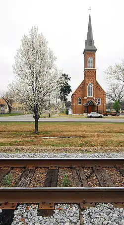
 Atkins Roman Catholic Church of the Assumption | |
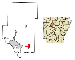
 Location of Atkins in Pope County, Arkansas. | |
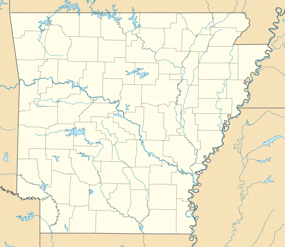
 Atkins Location in Arkansas. | |
| Coordinates: 35°14′37″N 92°56′18″W | |
| Country | United States |
| State | Arkansas |
| County | Pope |
| Area | |
| • Total | 6.14 sq mi (15.89 km2) |
| • Land | 6.13 sq mi (15.88 km2) |
| • Water | 0.01 sq mi (0.01 km2) |
| Elevation | 367 ft (112 m) |
| Population (2020) | |
| • Total | 2,859 |
| • Density | 466.39/sq mi (180.09/km2) |
| Time zone | UTC−06:00 (Central (CST)) |
| • Summer (DST) | UTC−05:00 (CDT) |
| ZIP Code | 72823 |
| Area code | 479 |
| FIPS code | 05-02590 |
| GNIS feature ID | 2403125[2] |
Geography
Atkins is located at 35°14′37″N 92°56′18″W (35.243485, -92.938212).[3]
According to the United States Census Bureau, the city has a total area of 6.1 square miles (16 km2), all land. Many Atkins residents commute to nearby Russellville for work, school, and recreation.
History
The town is named after Elisha Atkins,[4] a Boston sugar importer who financed the Little Rock and Fort Smith Railroad which spawned the growth of the town after the Civil War. It was formally platted in 1872. Atkins built its first school in 1875 and boasted its own newspaper, the Atkins Chronicle in 1894. The town served as a local cotton depot with a number of cotton gins operating in town. The 1927 flooding of the Arkansas River damaged the town and subsequent road buildings gradually shifted the town to orient northwards away from the river.[5]
Atkins was the site of the Goldsmith Pickle Company which started producing pickled cucumbers in 1946. The town thus laid claim to be the “Pickle Capital of the World” with some 1200 acres devoted to growing cucumbers. Along the same line Atkins was the original home of the fried dill pickle, created by Bernell “Fatman” Austin.[6] The pickle plant came under owners through the years until 2002 when the plant shuttered but left the town with the two-day "Picklefest" legacy held each May.[7]
Demographics
| Census | Pop. | Note | %± |
|---|---|---|---|
| 1880 | 519 | — | |
| 1890 | 660 | 27.2% | |
| 1900 | 745 | 12.9% | |
| 1910 | 1,258 | 68.9% | |
| 1920 | 1,529 | 21.5% | |
| 1930 | 1,364 | −10.8% | |
| 1940 | 1,322 | −3.1% | |
| 1950 | 1,291 | −2.3% | |
| 1960 | 1,391 | 7.7% | |
| 1970 | 2,015 | 44.9% | |
| 1980 | 3,002 | 49.0% | |
| 1990 | 2,834 | −5.6% | |
| 2000 | 2,878 | 1.6% | |
| 2010 | 3,016 | 4.8% | |
| 2020 | 2,859 | −5.2% | |
| U.S. Decennial Census[8] 2014 Estimate[9] | |||
2020 census
| Race | Number | Percentage |
|---|---|---|
| White (non-Hispanic) | 2,556 | 89.4% |
| Black or African American (non-Hispanic) | 21 | 0.73% |
| Native American | 19 | 0.66% |
| Asian | 7 | 0.24% |
| Pacific Islander | 1 | 0.03% |
| Other/Mixed | 156 | 5.46% |
| Hispanic or Latino | 99 | 3.46% |
As of the 2020 United States census, there were 2,859 people, 1,164 households, and 759 families residing in the city.
2010 census
As of the census[11] of 2010, there were 3,016 people in 1,118 households, including 849 families, in the city. The population density was 471.8 inhabitants per square mile (182.2/km2). There were 1,288 housing units at an average density of 211.1 per square mile (81.5/km2). The racial makeup of the city was 95.6% White, 0.9% Black or African American, 0.8% Native American, 0.1% Asian, 1.2% from other races, and 1.2% from two or more races. 2.3% of the population were Hispanic or Latino of any race.
Of the 1,118 households 30.4% had children under the age of 18 living with them, 53% were married couples living together, 12.1% had a female householder with no husband present, and 28.4% were non-families. 25.3% of households were one person and 11.2% were one person aged 65 or older. The average household size was 2.50 and the average family size was 2.95.
The age distribution was 23.4% under the age of 18, 9.4% from 18 to 24, 25% from 25 to 44, 24.5% from 45 to 64, and 17.7% 65 or older. The median age was 38.8 years. For every 100 females, there were 90.4 males. For every 100 females age 18 and over, there were 90.7 males.
The median household income was $40,112 and the median family income was $49,754. Males had a median income of $33,191 versus $38,833 for females. The per capita income for the city was $18,605. About 6.4% of families and 8.8% of the population were below the poverty line, including 6.3% of those under age 18 and 7.9% of those age 65 or over.
Notable people
- Ellis Kinder, major league baseball pitcher; Atkins native[12]
- Wilson Matthews, former University of Arkansas assistant football coach; Atkins native
- Norris Church Mailer, writer, wife of Norman Mailer
References
- "2020 U.S. Gazetteer Files". United States Census Bureau. Retrieved October 29, 2021.
- U.S. Geological Survey Geographic Names Information System: Atkins, Arkansas
- "US Gazetteer files: 2010, 2000, and 1990". United States Census Bureau. February 12, 2011. Retrieved April 23, 2011.
- "Atkins Historic District, National Register of Historic Places" (PDF). Arkansas Heritage. Department of Parks, Heritage and Tourism. July 13, 2009. Retrieved May 1, 2023.
In 1873, the town of Atkins was established with the coming of the Iron Mountain Railroad. The railroad ran from Little Rock to Fort Smith. The town was named for Elisha Atkins, a financier from Boston, Massachusetts, who volunteered to finish the building of the railroad after the stockholders ran out of money three miles from (what became Atkins). The stockholders named the town Atkins in his honor...
- "Atkins, Pope County"
- "Atkins"
- "The Atkins Pickle Company"
- "Census of Population and Housing". Census.gov. Retrieved June 4, 2015.
- "Annual Estimates of the Resident Population for Incorporated Places: April 1, 2010 to July 1, 2014". Archived from the original on May 22, 2015. Retrieved June 4, 2015.
- "Explore Census Data". data.census.gov. Retrieved January 1, 2022.
- "U.S. Census website". United States Census Bureau. Retrieved January 10, 2017.
- Reichler, Joseph L., ed. (1979) [1969]. The Baseball Encyclopedia (4th ed.). New York: Macmillan Publishing. ISBN 0-02-578970-8.
