Abbasabad County
Abbasabad County (Persian: شهرستان عباسآباد) is in Mazandaran province, Iran. Its capital is the city of Abbasabad.
Abbasabad County
Persian: شهرستان عباسآباد | |
|---|---|
County | |
 Abbasabad County in the fall | |
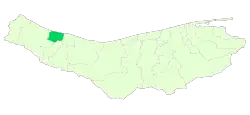 Location of Abbasabad County in Mazandaran province | |
 Location of Mazandaran province in Iran | |
| Coordinates: 36°39′N 51°10′E[1] | |
| Country | Iran |
| Province | Mazandaran |
| Capital | Abbasabad |
| Districts | Central, Kelar, Salman Shahr |
| Population (2016)[2] | |
| • Total | 52,832 |
| Time zone | UTC+3:30 (IRST) |
At the 2006 census, the region's population (as Abbasabad District of Tonekabon County) was 45,589 in 12,694 households.[3] It was separated from Tonekabon County in 2009.[4] The following census in 2011 counted 47,591 people in 14,568 households.[5] At the 2016 census, the county's population was 52,832 in 17,345 households.[2]
Administrative divisions
The population history and structural changes of Abbasabad County's administrative divisions over three consecutive censuses are shown in the following table. The latest census shows three districts, five rural districts, and three cities.[2]
| Administrative divisions | 2006[3] | 2011[5] | 2016[2] |
|---|---|---|---|
| Central District | 22,095 | 22,946 | 25,436 |
| Langarud Rural District | 10,839 | ||
| Langarud-e Gharbi Rural District | 2,818 | 3,011 | |
| Langarud-e Sharqi Rural District | 8,529 | 8,943 | |
| Abbasabad (city) | 11,256 | 11,599 | 13,482 |
| Kelar District | 23,494 | 24,645 | 10,969 |
| Kelar-e Gharbi Rural District | 5,804 | 2,293 | |
| Kelar-e Sharqi Rural District | 4,261 | 2,409 | |
| Kelarabad Rural District | 8,445 | ||
| Kelarabad (city) | 5,457 | 5,926 | 6,267 |
| Salman Shahr (city) | 9,592 | 8,654 | |
| Salmanshahr District | 16,427 | ||
| Kelarabad-e Gharbi Rural District | 6,771 | ||
| Salman Shahr (city) | 9,656 | ||
| Total | 45,589 | 47,591 | 52,832 |
| 1As a part of Tonekabon County at the 2006 census | |||
Wikimedia Commons has media related to Abbasabad County.
References
- OpenStreetMap contributors (20 May 2023). "Abbasabad County" (Map). OpenStreetMap. Retrieved 20 May 2023.
- "Census of the Islamic Republic of Iran, 1395 (2016)". AMAR (in Persian). The Statistical Center of Iran. p. 02. Archived from the original (Excel) on 7 October 2021. Retrieved 19 December 2022.
- "Census of the Islamic Republic of Iran, 1385 (2006)". AMAR (in Persian). The Statistical Center of Iran. p. 02. Archived from the original (Excel) on 20 September 2011. Retrieved 25 September 2022.
- Davoodi, Parviz (3 March 2018). "Divisional reforms and changes in Mazandaran province". Qavanin (in Persian). Ministry of Interior, Cabinet of Ministers. Archived from the original on 20 May 2023. Retrieved 20 May 2023.
- "Census of the Islamic Republic of Iran, 1390 (2011)" (Excel). Iran Data Portal (in Persian). The Statistical Center of Iran. p. 02. Retrieved 19 December 2022.
| Capital | |||||||||||||||||
|---|---|---|---|---|---|---|---|---|---|---|---|---|---|---|---|---|---|
| Districts |
| ||||||||||||||||
This article is issued from Wikipedia. The text is licensed under Creative Commons - Attribution - Sharealike. Additional terms may apply for the media files.