Yunak
Yunak is a municipality and district of Konya Province, Turkey.[3] Its area is 2,101 km2,[4] and its population is 20,991 (2022).[2]
Yunak | |
|---|---|
District and municipality | |
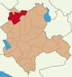 Map showing Yunak District in Konya Province | |
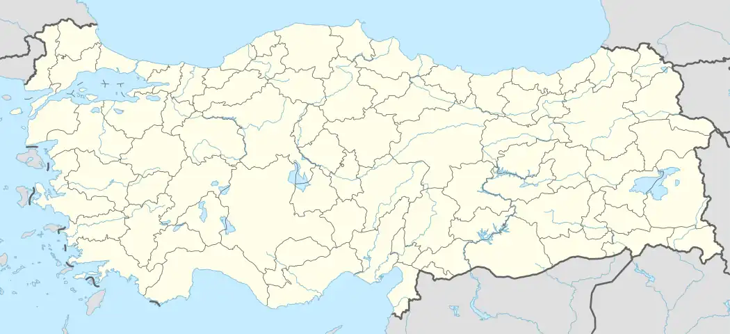 Yunak Location in Turkey  Yunak Yunak (Turkey Central Anatolia) | |
| Coordinates: 38°49′02″N 31°44′08″E | |
| Country | Turkey |
| Province | Konya |
| Government | |
| • Mayor | Ali Konak[1] (AKP) |
| Area | 2,101 km2 (811 sq mi) |
| Elevation | 1,080 m (3,540 ft) |
| Population (2022)[2] | 20,991 |
| • Density | 10.0/km2 (26/sq mi) |
| Time zone | TRT (UTC+3) |
| Postal code | 42530 |
| Area code | 0332 |
| Website | www |
Composition
There are 42 neighbourhoods in Yunak District:[5]
- Altınöz
- Ayrıtepe
- Beşışıklı
- Böğrüdelik
- Çayırbaşı
- Cebrail
- Eğrikuyu
- Esentepe
- Eşme
- Fatih
- Hacıfakılı
- Hacıömeroğlu
- Harunlar
- Hatırlı
- Hursunlu
- İmamoğlu
- Karataş
- Karayayla
- Kargalı
- Kıllar
- Koçyazı
- Kurtuşağı
- Kuyubaşı
- Kuzören
- Meşelik
- Odabaşı
- Ortakışla
- Özyayla
- Piribeyli
- Saray
- Selçuk
- Sertler
- Sevinç
- Sinanlı
- Sıram
- Sülüklü
- Turgut
- Yavaşlı
- Yeni
- Yeşiloba
- Yeşilyayla
- Yığar
References
- "Başkan". Yunak Belediyesi.
- "Address-based population registration system (ADNKS) results dated 31 December 2022, Favorite Reports" (XLS). TÜİK. Retrieved 19 September 2023.
- Büyükşehir İlçe Belediyesi, Turkey Civil Administration Departments Inventory. Retrieved 19 September 2023.
- "İl ve İlçe Yüz ölçümleri". General Directorate of Mapping. Retrieved 19 September 2023.
- Mahalle, Turkey Civil Administration Departments Inventory. Retrieved 19 September 2023.
External links
- District governor's official website (in Turkish)
- District municipality's official website (in Turkish)
This article is issued from Wikipedia. The text is licensed under Creative Commons - Attribution - Sharealike. Additional terms may apply for the media files.