Wikieup, Arizona
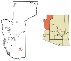
Wikieup is an unincorporated community and census-designated place (CDP) located on U.S. Route 93 in Mohave County, Arizona, United States. It is located approximately 139 miles (224 km) northwest of Phoenix and 162 miles (261 km) southeast of Las Vegas. As of the 2020 census, the population of Wikieup was 135.[3]
Wikieup, Arizona | |
|---|---|
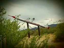
 Wikieup Snoopy rocket | |
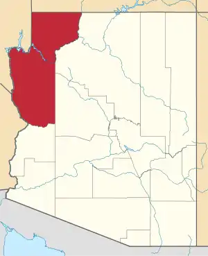
 Location in Mohave County, Arizona | |
| Coordinates: 34°42′12″N 113°36′41″W[1] | |
| Country | United States |
| State | Arizona |
| Counties | Mohave |
| Area | |
| • Total | 4.44 sq mi (11.49 km2) |
| • Land | 4.44 sq mi (11.49 km2) |
| • Water | 0.00 sq mi (0.00 km2) |
| Elevation | 1,997 ft (609 m) |
| Population | |
| • Total | 135 |
| • Density | 30.42/sq mi (11.75/km2) |
| Time zone | UTC-7 (MST) |
| ZIP code | 85360 |
| Area code | 928 |
| FIPS code | 04-82880 |
| GNIS feature ID | 24690 [1] |
Geography
Wikieup is in southeastern Mohave County in the valley of the Big Sandy River, between the Hualapai Mountains to the west and the Aquarius Mountains to the east. U.S. Route 93 passes through the community, leading northwest 54 miles (87 km) to Kingman, the Mohave county seat, and southeast 74 miles (119 km) to Wickenburg.
Climate
Wikieup has a hot desert climate (Köppen: BWh). The lowest recorded temperature was 14 °F (−10 °C) in 1990, with a high of 119 °F (48 °C) recorded in 1995. Average lows for January range from 33 to 64 °F (1 to 18 °C), with highs in July ranging from 68 to 105 °F (20 to 41 °C). Rainfall averages 9.88 inches (251 mm) annually. [4]
| Climate data for Wikieup, Arizona, 1991–2020 normals, extremes 1952–present | |||||||||||||
|---|---|---|---|---|---|---|---|---|---|---|---|---|---|
| Month | Jan | Feb | Mar | Apr | May | Jun | Jul | Aug | Sep | Oct | Nov | Dec | Year |
| Record high °F (°C) | 83 (28) |
93 (34) |
97 (36) |
103 (39) |
110 (43) |
120 (49) |
120 (49) |
118 (48) |
116 (47) |
109 (43) |
96 (36) |
87 (31) |
120 (49) |
| Average high °F (°C) | 65.7 (18.7) |
68.1 (20.1) |
75.0 (23.9) |
82.4 (28.0) |
91.0 (32.8) |
101.1 (38.4) |
105.1 (40.6) |
103.6 (39.8) |
98.0 (36.7) |
87.0 (30.6) |
74.9 (23.8) |
64.6 (18.1) |
84.7 (29.3) |
| Daily mean °F (°C) | 50.0 (10.0) |
51.9 (11.1) |
57.5 (14.2) |
63.5 (17.5) |
71.8 (22.1) |
80.8 (27.1) |
87.5 (30.8) |
86.6 (30.3) |
80.1 (26.7) |
68.9 (20.5) |
57.3 (14.1) |
48.9 (9.4) |
67.1 (19.5) |
| Average low °F (°C) | 34.4 (1.3) |
35.8 (2.1) |
40.1 (4.5) |
44.6 (7.0) |
52.6 (11.4) |
60.5 (15.8) |
69.9 (21.1) |
69.6 (20.9) |
62.2 (16.8) |
50.8 (10.4) |
39.8 (4.3) |
33.2 (0.7) |
49.5 (9.7) |
| Record low °F (°C) | 15 (−9) |
8 (−13) |
17 (−8) |
21 (−6) |
30 (−1) |
39 (4) |
50 (10) |
47 (8) |
37 (3) |
25 (−4) |
20 (−7) |
14 (−10) |
8 (−13) |
| Average precipitation inches (mm) | 1.28 (33) |
1.30 (33) |
1.15 (29) |
0.20 (5.1) |
0.13 (3.3) |
0.04 (1.0) |
0.57 (14) |
1.16 (29) |
0.73 (19) |
0.56 (14) |
0.58 (15) |
0.73 (19) |
8.43 (214) |
| Average snowfall inches (cm) | 0.2 (0.51) |
0.0 (0.0) |
0.0 (0.0) |
0.0 (0.0) |
0.0 (0.0) |
0.0 (0.0) |
0.0 (0.0) |
0.0 (0.0) |
0.0 (0.0) |
0.0 (0.0) |
0.0 (0.0) |
0.0 (0.0) |
0.2 (0.51) |
| Average precipitation days (≥ 0.01 in) | 3.0 | 2.9 | 2.4 | 1.2 | 0.9 | 0.3 | 2.7 | 3.4 | 2.3 | 1.6 | 1.1 | 2.3 | 24.1 |
| Source: NOAA[5][6] | |||||||||||||
History
.jpg.webp)
There is a vandalized historic marker in Wikieup whose inscription once read:
"First exploration probably by early Spanish explorers, Espejo in 1582 and Farfan in 1589. Explored later by Lt. Amiel W. Whipple in 1854. Important agriculture, mining, milling, and smelting area in our early days. The McCrackin Mine discovered by Jackson McCrackin and H. A. "Chloride Jack" Owen in 1874, lies 18 miles south. The Signal Mine was 12 miles south. Stamp mills were at Greenwood, 8 miles southwest and at Virginia City, 9 miles southwest. Cofer Hot Springs 3 miles east."[8]
Education
Residents are zoned to the Owens-Whitney Elementary School District, which operates one K-8 school.[9] Students may choose to attend Bagdad Unified School District or Kingman Unified School District for high school.[10]
Notable people
- Donald Machholz (1952-2022): American amateur astronomer who was credited with the discovery of 12 comets that bear his name.
References
- U.S. Geological Survey Geographic Names Information System: Wikieup, Arizona
- "2021 U.S. Gazetteer Files: Arizona". United States Census Bureau. Retrieved May 26, 2022.
- "P1. Race – Wikieup CDP, Arizona: 2020 DEC Redistricting Data (PL 94-171)". U.S. Census Bureau. Retrieved May 26, 2022.
- "Wikieup, AZ - Wikieup, Arizona Map & Directions - MapQuest". www.mapquest.com. Retrieved October 21, 2021.
- "NOWData - NOAA Online Weather Data". National Oceanic and Atmospheric Administration. Retrieved October 7, 2022.
- "Summary of Monthly Normals 1991-2020". National Oceanic and Atmospheric Administration. Retrieved October 7, 2022.
- "Census of Population and Housing". Census.gov. Retrieved June 4, 2016.
- "Big Sandy Valley - Arizona Historical Markers on Waymarking.com". www.waymarking.com. Retrieved October 21, 2021.
- "2020 CENSUS - SCHOOL DISTRICT REFERENCE MAP: Mohave County, AZ" (PDF). U.S. Census Bureau. Retrieved January 30, 2022.
- "Home". Owens-Whitney Elementary School District. Retrieved January 30, 2022.
Owens transitions high school students to Kingman and Bagdad.
External links
 Media related to Wikieup, Arizona at Wikimedia Commons
 Wikieup, Arizona travel guide from Wikivoyage
