Powell, Arizona
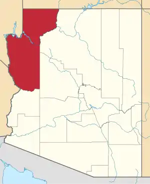
Powell was a railroad station and settlement in Mohave County, Arizona, United States from 1883 to 1890.
Powell, Arizona | |
|---|---|
 Powell  Powell | |
| Coordinates: 34°44′14″N 114°22′37″W[1] | |
| Country | United States |
| State | Arizona |
| County | Mohave |
| Founded | 1883 |
| Time zone | UTC-7 (MST (no DST)) |
History
Powell was a station on the Atlantic and Pacific Railroad, at the point where the railroad began crossing the lower Mohave Valley to the Colorado River bridge at the station at Eastbridge, Arizona southeast of Needles, California.[2] It had a post office from October 11, 1883 until it was discontinued July 9, 1886, in favor of Mohave City.[3] From 1903 to 1909 Mellen had its own post office.[4]: 120
The bridge across the Colorado River constructed at Eastbridge station in 1883 was washed out or undermined by the spring flooding of the river in 1884, 1886 and 1888. Finally they changed the railroad route southward Beal to Mellen, where from 1889 to May 1890 they built the Red Rock Bridge, a cantilever bridge, on rock foundations, unlike the previous site. The section of track between where the line changed direction to the new bridge, to the station of Powell and the bridge and station at Eastbridge, was abandoned in 1890.[5]: 82
The site today
The site of Powell lies under the waters of Goose Lake in Topock Marsh near where the remnant of the old rail bed descends into the waters of the marsh.
References
- U.S. Geological Survey Geographic Names Information System: Powell (populated place)
- U.S. Geological Survey Geographic Names Information System: Powell Railroad Station (building) – 34°44′14″N 114°22′39″W
- US 66 Photo Gallery Needles and the Colorado River from gbcnet.com accessed 11/1/2114.
- John and Lillian Theobald, Arizona Territory Post Offices & Postmasters, The Arizona Historical Foundation, Phoenix, 1961.
- Richard E. Lingenfelter, Steamboats on the Colorado River, 1852–1916, University of Arizona Press, Tucson, 1978
External links
- Map of the 5th Operating Division of the Western Division, Atlantic & Pacific R.R., From Peach Springs to Needles. W.A. Drake, Acting Chief Engineer. Drawing No. J-2-902. from davidrumsey.com accessed July 20, 2015. This map was one of a set of six hand-drawn maps made in 1882 on semi-transparent waxed linen with some color, illustrating the route Lewis Kingman surveyed from Albuquerque to Needles. It was intended to be printed but never was, due possibly to the problems at the bridge at Eastbridge, shown on this map, from 1884 to 1890.
- Map of the 6th Operating Division of the Western Division, Atlantic & Pacific R.R., From Needles to Mojave. Saml. M. Rowe, Resident Engineer. Drawing No. J-2-902, 1882 from davidrumsey.com accessed July 20, 2015. This map was one of a set of six hand-drawn maps made in 1882 on semi-transparent waxed linen with some color, illustrating the route Lewis Kingman surveyed from Albuquerque to Needles. It was intended to be printed but never was, due possibly to the problems at the bridge and station at Eastbridge which was abandoned, shown on this map that shows the change of route south along the west bank to Beal, and to that new bridge at Mellen and the abandoned station Powell that can be seen partially erased on the map.
