West Township, Effingham County, Illinois
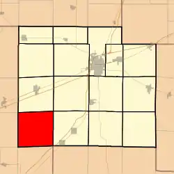
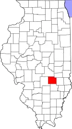
West Township is one of fifteen townships in Effingham County, Illinois, USA. As of the 2010 census, its population was 467 and it contained 175 housing units.[2]
West Township | |
|---|---|
 Location in Effingham County | |
 Effingham County's location in Illinois | |
| Coordinates: 38°58′N 88°45′W | |
| Country | United States |
| State | Illinois |
| County | Effingham |
| Established | November 6, 1860 |
| Area | |
| • Total | 36.95 sq mi (95.7 km2) |
| • Land | 36.91 sq mi (95.6 km2) |
| • Water | 0.04 sq mi (0.1 km2) 0.11% |
| Elevation | 571 ft (174 m) |
| Population (2010) | |
| • Estimate (2016)[1] | 463 |
| • Density | 12.7/sq mi (4.9/km2) |
| Time zone | UTC-6 (CST) |
| • Summer (DST) | UTC-5 (CDT) |
| ZIP codes | 62411, 62426, 62443, 62458, 62838 |
| FIPS code | 17-049-79891 |
Geography
According to the 2010 census, the township (T6N R4E) has a total area of 36.95 square miles (95.7 km2), of which 36.91 square miles (95.6 km2) (or 99.89%) is land and 0.04 square miles (0.10 km2) (or 0.11%) is water.[2]
Extinct towns
- Gilmore
Cemeteries
The township contains these five cemeteries: Beck William, Besing, Faulk, Kavanaugh and Mahon.
School districts
- Altamont Community Unit School District 10
- Effingham Community Unit School District 40
- St Elmo Community Unit School District 202
Political districts
- Illinois' 19th congressional district
- Illinois State House District 110; Blaine Wilhour (R), Beecher City, IL
- Illinois State Senate District 55; Jason Plummer (R), Vandalia, IL
- Effingham County Board District G (Doug McCain (D), elected 2020; term expires 2024)
- West Township elected officials elected April 2021, are: Township Supervisor, Scott A. Beal (R); Town Clerk, Iris Ashbaugh (R); Township Highway Commissioner, Mel Stuemke (R) ; Township Trustees: Wendell Alwardt (R), Mark Holland (I), Michael Runge (R), Bradley Suckow (R). Township official offices all expire in May 2025.
References
- "West Township, Effingham County, Illinois". Geographic Names Information System. United States Geological Survey, United States Department of the Interior. Retrieved January 16, 2010.
- United States Census Bureau 2007 TIGER/Line Shapefiles
- United States National Atlas
- "Population and Housing Unit Estimates". Retrieved June 9, 2017.
- "Population, Housing Units, Area, and Density: 2010 - County -- County Subdivision and Place -- 2010 Census Summary File 1". United States Census. Archived from the original on February 12, 2020. Retrieved May 28, 2013.
- "Census of Population and Housing". Census.gov. Retrieved June 4, 2016.
External links
This article is issued from Wikipedia. The text is licensed under Creative Commons - Attribution - Sharealike. Additional terms may apply for the media files.