Wenona, Georgia
Wenona is an unincorporated community and census-designated place (CDP) in Crisp County, Georgia, United States. It is on U.S. Route 41 where it is joined by Georgia State Route 33, 4 miles (6 km) south of Cordele, the county seat, and 5 miles (8 km) north of Arabi. Interstate 75 forms the eastern border of the CDP, with access from Exit 97.
Wenona, Georgia | |
|---|---|
 Wenona  Wenona | |
| Coordinates: 31°54′16″N 83°45′49″W | |
| Country | |
| State | Georgia |
| County | Crisp |
| Area | |
| • Total | 2.86 sq mi (7.42 km2) |
| • Land | 2.84 sq mi (7.34 km2) |
| • Water | 0.03 sq mi (0.07 km2) |
| Elevation | 338 ft (103 m) |
| Population (2020) | |
| • Total | 231 |
| • Density | 81.45/sq mi (31.45/km2) |
| Time zone | UTC-5 (Eastern (EST)) |
| • Summer (DST) | UTC-4 (EDT) |
| ZIP Code | 31015 (Cordele) |
| Area code | 229 |
| FIPS code | 13-81208 |
| GNIS feature ID | 2812675[2] |
It was first listed as a CDP in the 2020 census with a population of 231.[3]
Demographics
| Census | Pop. | Note | %± |
|---|---|---|---|
| 2020 | 231 | — | |
| U.S. Decennial Census[4] 2020[5] | |||
2020 census
| Race / Ethnicity | Pop 2020[5] | % 2020 |
|---|---|---|
| White alone (NH) | 152 | 65.80% |
| Black or African American alone (NH) | 64 | 27.71% |
| Native American or Alaska Native alone (NH) | 0 | 0.00% |
| Asian alone (NH) | 1 | 0.43% |
| Pacific Islander alone (NH) | 0 | 0.00% |
| Some Other Race alone (NH) | 0 | 0.00% |
| Mixed Race/Multi-Racial (NH) | 8 | 3.46% |
| Hispanic or Latino (any race) | 6 | 2.60% |
| Total | 231 | 100.00% |
Note: the US Census treats Hispanic/Latino as an ethnic category. This table excludes Latinos from the racial categories and assigns them to a separate category. Hispanics/Latinos can be of any race.
References
- "2020 U.S. Gazetteer Files". United States Census Bureau. Retrieved December 18, 2021.
- "Wenona Census Designated Place". Geographic Names Information System. United States Geological Survey, United States Department of the Interior.
- "Wenona CDP, Georgia". United States Census Bureau. Retrieved April 7, 2022.
- "Decennial Census of Population and Housing by Decades". US Census Bureau.
- "P2 HISPANIC OR LATINO, AND NOT HISPANIC OR LATINO BY RACE – 2020: DEC Redistricting Data (PL 94-171) – Waynesville CDP, Georgia". United States Census Bureau.
Municipalities and communities of Crisp County, Georgia, United States | ||
|---|---|---|
| City | 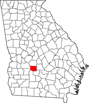 Map of Georgia highlighting Crisp County | |
| Town | ||
| CDP | ||
| Other unincorporated communities | ||
This article is issued from Wikipedia. The text is licensed under Creative Commons - Attribution - Sharealike. Additional terms may apply for the media files.