Waverley, Queensland
Waverley is an outback locality in the Shire of Boulia, Queensland, Australia.[2] In the 2021 census, Waverley had a population of 6 people.[3]
| Waverley Queensland | |||||||||||||||
|---|---|---|---|---|---|---|---|---|---|---|---|---|---|---|---|
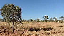 Landscape beside the Boulia Mount Isa Highway, 2019 | |||||||||||||||
 Waverley | |||||||||||||||
| Coordinates | 21.5768°S 139.0092°E | ||||||||||||||
| Population | 6 (SAL 2021)[1] | ||||||||||||||
| Postcode(s) | 4825 | ||||||||||||||
| Area | 9,244.8 km2 (3,569.4 sq mi) | ||||||||||||||
| Time zone | AEST (UTC+10:00) | ||||||||||||||
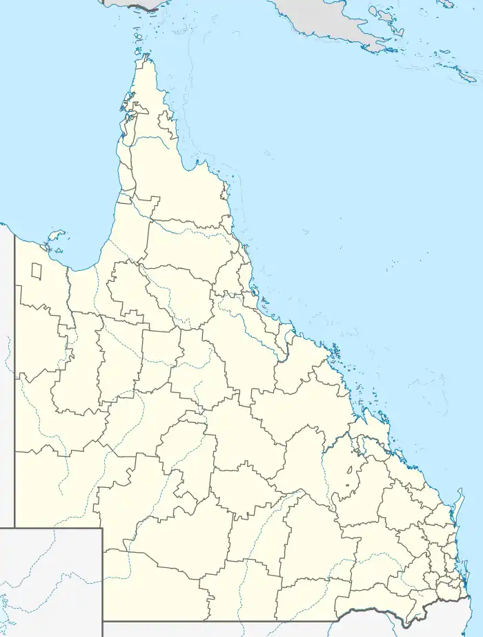
| Location |
| ||||||||||||||
| LGA(s) | Shire of Boulia | ||||||||||||||
| State electorate(s) | Gregory | ||||||||||||||
| Federal division(s) | Kennedy | ||||||||||||||
| |||||||||||||||
Geography
Waverley is in the Channel Country. All watercourses in this area are part of the Lake Eyre drainage basin,[4] and most will dry up before their water reaches Lake Eyre.[5]
The predominant land use is grazing on native vegetation.[4]
The Boulia Mount Isa Highway enters the locality from the north-east (Mount Isa) and exits to the east (Dajarra).[4]
Waverley has the following mountains (from north to south):
- Rifle Creek Hill (20.9537°S 139.5171°E) 542 metres (1,778 ft)[6]
- Mount Guide (21.0375°S 139.5196°E)[6][7]
- Mount Woodhouse (21.0991°S 139.1348°E)[6][8]
- Pinnacle Knob (21.8851°S 139.0727°E) 276 metres (906 ft)[6][9]
- Steamboat Hill (21.9094°S 139.0701°E) 301 metres (988 ft)[6][10]
- McCabe Knob (22.3101°S 138.9468°E)[6][11]
History
.jpg.webp)
In the 2016 census, Waverley had a population of 20 people.[12]
In the 2021 census, Waverley had a population of 6 people.[3]
Heritage listings
Waverley has a number of heritage-listed sites, including:
- Ardmore Station: Moonah Creek Hanging Tree[13]
Education
There are no schools in Waverley. The nearest primary schools are in Mount Isa and Dajarra but might be infeasible for a daily commute.[4] The nearest secondary school is in Mount Isa.[4] The Spinifex State College in Mount Isa offers boarding facilities.[14] Other boarding schools or distance education would be options.
Economy
There are a number of homesteads in the locality (from north to south):[15]
- Mount Guide (21.0082°S 139.4067°E)
- Sheila Outstation (21.1992°S 138.8466°E)
- Oban (21.2339°S 139.0460°E)
- Suva Downs Outstation (21.6055°S 138.7426°E)
- Ardmore (21.6481°S 139.1844°E)
- Douglas Downs Outstation (21.6576°S 138.9339°E)
- Kallala (21.7585°S 138.8855°E)
- Quewar Outstation (21.9139°S 138.9142°E)
References
- Australian Bureau of Statistics (28 June 2022). "Waverley (Qld) (Suburb and Locality)". Australian Census 2021 QuickStats. Retrieved 28 June 2022.
- "Waverley – locality in Shire of Boulia (entry 42348)". Queensland Place Names. Queensland Government. Retrieved 10 June 2019.
- Australian Bureau of Statistics (28 June 2022). "Waverley (SAL)". 2021 Census QuickStats. Retrieved 28 February 2023.
- "Queensland Globe". State of Queensland. Retrieved 31 May 2023.
- FitzSimons, Trish (2010). "Channel Country". Queensland Historical Atlas. University of Queensland. Archived from the original on 15 August 2019. Retrieved 15 August 2019.
- "Mountain peaks and capes - Queensland". Queensland Open Data. Queensland Government. 12 November 2020. Archived from the original on 25 November 2020. Retrieved 25 November 2020.
- "Mount Guide – mountain in Boulia Shire (entry 14937)". Queensland Place Names. Queensland Government. Retrieved 25 November 2020.
- "Mount Woodhouse – mountain in Boulia Shire (entry 37979)". Queensland Place Names. Queensland Government. Retrieved 25 November 2020.
- "Pinnacle Knob – mountain in Boulia Shire (entry 26935)". Queensland Place Names. Queensland Government. Retrieved 25 November 2020.
- "Steamboat Hill – mountain in Boulia Shire (entry 32309)". Queensland Place Names. Queensland Government. Retrieved 25 November 2020.
- "McCabe Knob – mountain in Boulia Shire (entry 21301)". Queensland Place Names. Queensland Government. Retrieved 25 November 2020.
- Australian Bureau of Statistics (27 June 2017). "Waverley (SSC)". 2016 Census QuickStats. Retrieved 20 October 2018.
- "Moonah Creek 'Hanging Tree' (entry 600040)". Queensland Heritage Register. Queensland Heritage Council. Retrieved 7 July 2013.
- "Residential Campus" (PDF). Spinifex State College. 2015. Archived (PDF) from the original on 15 August 2019. Retrieved 15 August 2019.
- "Homesteads - Queensland". Queensland Open Data. Queensland Government. 18 November 2020. Archived from the original on 24 November 2020. Retrieved 24 November 2020.