Wattamolla, New South Wales
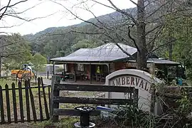
Wattamolla is a locality in the City of Shoalhaven in New South Wales, Australia.[2][3] It lies in the valley of Brogers Creek about 16 km east of Kangaroo Valley. At the 2016 census, it had a population of 61.[1]
| Wattamolla New South Wales | |||||||||||||||
|---|---|---|---|---|---|---|---|---|---|---|---|---|---|---|---|
 | |||||||||||||||
 Wattamolla Location in New South Wales | |||||||||||||||
| Coordinates | 34°43′32″S 150°37′54″E | ||||||||||||||
| Population | 61 (2016 census)[1] | ||||||||||||||
| Postcode(s) | 2535 | ||||||||||||||
| Elevation | 139 m (456 ft) | ||||||||||||||
| Location |
| ||||||||||||||
| LGA(s) | City of Shoalhaven | ||||||||||||||
| Region | South Coast | ||||||||||||||
| County | Camden | ||||||||||||||
| Parish | Cambewarra | ||||||||||||||
| State electorate(s) | Kiama | ||||||||||||||
| Federal division(s) | Gilmore | ||||||||||||||
| |||||||||||||||
References
Wikimedia Commons has media related to Wattamolla.
- Australian Bureau of Statistics (27 June 2017). "Wattamolla". 2016 Census QuickStats. Retrieved 12 August 2017.
- "Wattamolla". Geographical Names Register (GNR) of NSW. Geographical Names Board of New South Wales. Retrieved 12 August 2017.
- "Wattamolla". OpenStreetMap. Retrieved 12 August 2017.
| Cities | |
|---|---|
| Towns & Townships |
|
| Local government areas | |
| National parks | |
| Rivers and other waterbodies | |
This article is issued from Wikipedia. The text is licensed under Creative Commons - Attribution - Sharealike. Additional terms may apply for the media files.