Vuka (river)
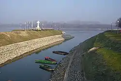
Vuka is a river in eastern Croatia, a right tributary of the Danube river. At 112 kilometres (70 miles), it is the 13th-longest river flowing through Croatia and it has a drainage area of 644 square kilometres (249 square miles).[1] The river is located in Vukovar-Srijem County, in the Slavonia region. It empties into the Danube at the town of Vukovar, which is named for the river.
| Vuka | |
|---|---|
 | |
| Location | |
| Country | Croatia |
| Physical characteristics | |
| Mouth | |
• location | Danube |
• coordinates | 45.3525°N 19.0052°E |
| Length | 112 km (70 mi)[1] |
| Basin size | 644 km2 (249 sq mi)[1] |
| Basin features | |
| Progression | Danube→ Black Sea |
The ancient name of Pannonian Illyrians for Vuka was Volcos.
Settlements along the river basin
- Borovik
- Podgorje Bračevačko
- Razbojište
- Budimci (2 km away)
- Krndija (1 km away)
- Jurjevac Punitovački
- Beketinci
- Hrastovac
- Vuka
- Dopsin (1 km away)
- Hrastin
- Hudeston (Named after Huđï)
- Petrova Slatina (0,5 km away)
- Paulin Dvor (0,8 km away)
- Ernestinovo (1,5 km away)
- Ada
- Laslovo
- Podrinje
- Palača (1 km away)
- Markušica
- Gaboš
- Antin (2 km away)
- Mlaka Antinska
- Ostrovo (2 km away)
- Tordinci
- Pačetin (2 km away[2])
- Nuštar (2 km away)
- Marinci
- Bršadin
- Bogdanovci
- Vukovar
See also
References
- Statistical Yearbook of the Republic of Croatia 2017 (PDF) (in Croatian and English). Zagreb: Croatian Bureau of Statistics. December 2017. p. 47. ISSN 1333-3305. Archived from the original (PDF) on 13 November 2018. Retrieved 23 May 2018.
- Marković, M. (2003). Istočna Slavonija: Stanovništvo i naselja. Naklada Jesenski i Turk. Zagreb.
Hydrography of Croatia | ||||||
|---|---|---|---|---|---|---|
| Rivers |
|  | ||||
| Lakes | ||||||
| Valleys, estuaries, canyons, wetlands | ||||||
| Waterfalls | ||||||
| Canals |
| |||||
| Adriatic Sea | ||||||
This article is issued from Wikipedia. The text is licensed under Creative Commons - Attribution - Sharealike. Additional terms may apply for the media files.