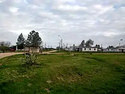
Vergara, Uruguay
Vergara is a small city in the Treinta y Tres Department of eastern Uruguay.
Vergara | |
|---|---|
City | |
 | |
 Flag  Coat of arms | |
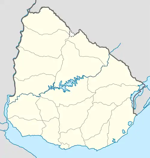 Vergara Location in Uruguay | |
| Coordinates: 32°57′0″S 53°56′0″W | |
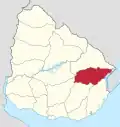
| Country | |
| Department | |
| Population (2011 Census) | |
| • Total | 3,810 |
| Time zone | UTC -3 |
| Postal code | 33002 |
| Dial plan | +598 4458 (+4 digits) |
Geography
It is located between Route 18, which passes to the northwest, and on Route 91, which passes to the southeast, and about 54 kilometres (34 mi) northeast of Treinta y Tres, the capital city of the department. The stream Arroyo Parao flows along the northeast limits of the town.
History
On 10 March 1903, the group of houses here was declared a "Pueblo" (village) by the Act of Ley Nº 2.788.[1] On 13 December 1994, its status was elevated to "Ciudad" (city) by the Act of Ley Nº 16.668[2]
Population
In 2011, Vergara had a population of 3,810.[3]
| Year | Population |
|---|---|
| 1963 | 2,837 |
| 1975 | 2,826 |
| 1985 | 3,379 |
| 1996 | 3,983 |
| 2004 | 3,985 |
| 2011 | 3,810 |
Source: Instituto Nacional de Estadística de Uruguay[1]
Places of worship
- Most Holy Sacrament Parish Church (Roman Catholic)
References
- "Statistics of urban localities (1963–2004)" (PDF). INE. 2012. Archived from the original (PDF) on 13 November 2009. Retrieved 6 September 2012.
- "Ley Nº 16.668". República Oriental del Uruguay, Poder Legislativo. 1964. Archived from the original on 28 March 2016. Retrieved 6 September 2012.
- "Censos 2011 Cuadros Trenta y Tres". INE. 2012. Archived from the original on 10 October 2012. Retrieved 25 August 2012.
This article is issued from Wikipedia. The text is licensed under Creative Commons - Attribution - Sharealike. Additional terms may apply for the media files.