Tshiame
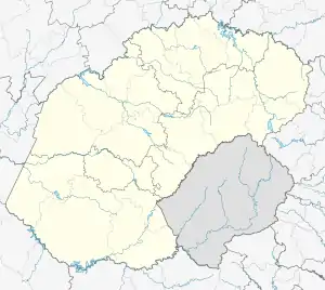
Tshiame is a settlement 12 km west of Harrismith in Maluti-a-Phofung Local Municipality, Thabo Mofutsanyana District Municipality in the Free State province of South Africa. It is named after Tshiame Kenneth Mopeli, Chief Minister of the defunct QwaQwa homeland.[2]
Tshiame | |
|---|---|
 Tshiame  Tshiame | |
| Coordinates: 28.2981°S 29.0090°E | |
| Country | South Africa |
| Province | Free State |
| District | Thabo Mofutsanyane |
| Municipality | Maluti-a-Phofung |
| • Councillor | (ANC) |
| Area | |
| • Total | 26.05 km2 (10.06 sq mi) |
| Population (2011)[1] | |
| • Total | 14,856 |
| • Density | 570/km2 (1,500/sq mi) |
| Racial makeup (2011) | |
| • Black African | 99.4% |
| • Coloured | 0.2% |
| • Indian/Asian | 0.1% |
| • White | 0.1% |
| • Other | 0.2% |
| First languages (2011) | |
| • Sotho | 55.9% |
| • Zulu | 36.1% |
| • English | 3.1% |
| • Sign language | 1.3% |
| • Other | 3.5% |
| Time zone | UTC+2 (SAST) |
| Area code | 058 |
The census area includes the QwaQwa industrial sites. The full perimeter of the industrial area is fenced in by modern technology, creating a "see-through wall" of wire mesh standing three metres tall. The fencing-in was done as a security measure, to keep unwanted elements out as a means to curb crime perpetrated in the area.
The settlement borders the N5 national road leading to Durban and the rest of KwaZulu-Natal, and is situated just north of the Sterkfontein Dam, a major water reservoir and the second largest dam by volume in South Africa. The large town of Phuthaditjhaba in the former QwaQwa lies further south of Tshiame.
References
- "Main Place Tshiame". Census 2011.
- Raper, Peter E.; Möller, Lucie A.; du Plessis, L. Theodorus (2014). Dictionary of Southern African Place Names (4th ed.). Johannesburg: Jonathan Ball. p. 505. ISBN 9781868425495.
.svg.png.webp)