Tolkamer
Tolkamer is a village near Lobith in the municipality of Zevenaar in the province of Gelderland, the Netherlands. The village is on the border with Germany.
Tolkamer | |
|---|---|
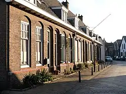
 Village street | |
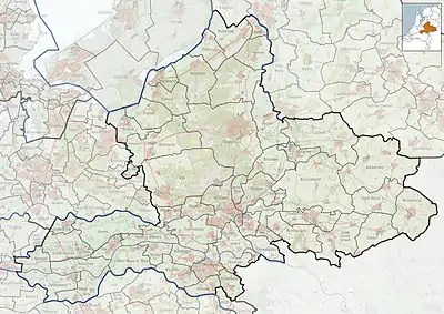
 Tolkamer Location in the Netherlands  Tolkamer Tolkamer (Netherlands) | |
| Coordinates: 51.8527°N 6.1027°E | |
| Country | Netherlands |
| Province | Gelderland |
| Municipality | Zevenaar |
| Area | |
| • Total | 1.19 km2 (0.46 sq mi) |
| Elevation | 16 m (52 ft) |
| Population (2021)[1] | |
| • Total | 2,745 |
| • Density | 2,300/km2 (6,000/sq mi) |
| Time zone | UTC+1 (CET) |
| • Summer (DST) | UTC+2 (CEST) |
| Postal code | 6916[1] |
| Dialing code | 0316 |
The village was first mentioned in 1773 as Tol, and means "toll room".[3] Otto I, Count of Guelders established a toll for traffic on the Rhine in 1224 which remained at Tolkamer until 1868.[3] The village developed along the river bank.[4] Around 1590, the Rhine and Waal diverged near Tolkamer which increased the importance of the village. Later, the village became a centre for brickworks.[5]
In 1920, a ship wharf was established, and a harbour was built in 1930.[4] Tolkamer and Lobith have grown into a single urban area and are often referred to as Lobith-Tolkamer, however they remain separate villages.[5]
References
- "Kerncijfers wijken en buurten 2021". Central Bureau of Statistics. Retrieved 26 March 2022.
- "Postcodetool for 6916AA". Actueel Hoogtebestand Nederland (in Dutch). Het Waterschapshuis. Retrieved 26 March 2022.
- "Tolkamer - (geografische naam)". Etymologiebank (in Dutch). Retrieved 26 March 2022.
- Ronald Stenvert & Sabine Broekhoven (2000). "Tolkamer" (in Dutch). Zwolle: Waanders. ISBN 90 400 9406 3. Retrieved 26 March 2022.
- "Tolkamer". Plaatsengids (in Dutch). Retrieved 26 March 2022.


