Timworth
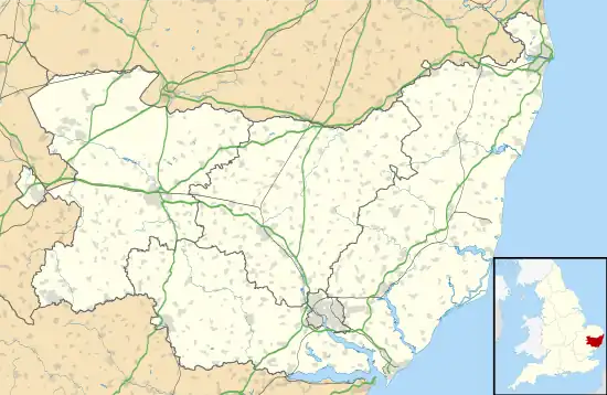
Timworth is a village and civil parish 65 mi (105 km) north east of London and 26 mi (42 km) east of Cambridge in the West Suffolk district of Suffolk in eastern England. Located around two miles north of Bury St Edmunds, its 2005 population was 50.[1] At the 2011 Census the appropriate Postal Code (IP31 1HS) showed the population as being included in Ampton.
| Timworth | |
|---|---|
 St Andrew's church, Timworth | |
 Timworth Location within Suffolk | |
| Area | 2.148 sq mi (5.56 km2) |
| Population | 50 [1] |
| • Density | 23/sq mi (8.9/km2) |
| District | |
| Shire county | |
| Region | |
| Country | England |
| Sovereign state | United Kingdom |
| Post town | Bury St Edmunds |
| Postcode district | IP31 |
| Police | Suffolk |
| Fire | Suffolk |
| Ambulance | East of England |
History
The village name is Old English for 'Tima's Enclosure' and was mentioned in the Doomesday Book as Timeworda located in the hundred of Thedwastre.[2]
The Domesday Book records the population of Timworth in 1086 as 38 households along with 6 acres of meadows. The land was held by Bury St Edmunds Abbey and Richard fitz Gilbert, before the Norman conquest of England the lands were held by the Abbey and Wihtgar son of Aelfric.[3]
Around the year 1200 a windmill situated in the village was given to the Abbey of Bury St Edmunds by the previous owner Reginald of Groton and his wife Amicia.[4]
John of Timworth served as Abbot of Bury St Edmunds between 1379 and 1389. His election to the abbacy was documented in Electio Johannis Tyworth by the Abbey almoner John Gosnold. This also covered the Peasants' Revolt which was exacerbated in the town by the election as his opponent, Edmund Bromfield, the papal nominee was supported by the townsfolk where as John was the Abbey's candidate.[5]
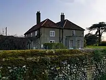
There are two listed buildings in the parish; the grade II listed Green Farmhouse and the grade II* listed Church of St Andrew.[6]

Prosecutions for gleaning
Over the harvests of 1785–1787, conflict escalated between land owners and gleaners in the village. The first case was brought against Timworth shoemaker Benjamin Manning, by farmer John Worlledge in 1786, who gleaned in neighbouring Ingham. The court held that the defendant was not an inhabitant of the parish in which he gleaned, and was not entitled to the gleaning support. The court therefore decided that a stranger had no right to glean. Worlledge was awarded £26 in damages.[7] The main advocate for the gleaners was Capel Lofft, Justice of the Peace, who had recently inherited the nearby halls at Stanton and Troston.[8]
The second and more widely impacting case came in 1788 when Mary Houghton, the wife of James a shoemaker and one of Timworth's last remaining freeholders, gleaned on the farm of James Steel, who subsequently sued for trespass. The court found in favour of Steel awarding him £35 5s,[9] and ruled that no person has a right at common law to glean the harvest of a private field. The judgement was taken to be a more general precedent for private land matters.[10] The case was widely reported and became known as The Great Gleaning Case. The subsequent debts and hardship that the case brought to the Houghtons forced them to twice mortgage then in 1796 auction their smallholding, which was one of the few remaining parts of the Culford estate parishes not yet under the control of the 1st Marquess Cornwallis. Its purchase almost certainly enabled him to complete the enclosure process and to bring to fruition his family's long-term plans to make it a closed parish and classic estate village.[11][12]
Historical writings
In 1870–72, John Marius Wilson's Imperial Gazetteer of England and Wales described the village as
TIMWORTH, a parish in Thingoe district, Suffolk; 3 miles N of Bury-St. Edmunds r. station. Post town, Bury-St. Edmunds. Acres, 1,358. Real property, £1,517. Pop., 222. Houses, 45. The living is a rectory, annexed to Ingham. The church is good.[13]
In 1887, John Bartholomew also wrote an entry on Timworth in the Gazetteer of the British Isles with a much shorter description:
Timworth, par., Suffolk, 3 miles N. of Bury St Edmunds, 1358 ac., pop. 179.[14]
Notable residents
- Edward Ward, clergyman and cricketer
References
- Estimates of Total Population of Areas in Suffolk Archived 2008-12-19 at the Wayback Machine Suffolk County Council
- "Key to English Place-names". kepn.nottingham.ac.uk. Retrieved 14 June 2019.
- "Timworth | Domesday Book". opendomesday.org. Retrieved 10 June 2019.
- Kealey, Edward J. (2020). Harvesting the Air (Reprint 2020 ed.). Berkeley, CA. p. 251. ISBN 978-0-520-32925-6. OCLC 1224279320.
{{cite book}}: CS1 maint: location missing publisher (link) - Arnold, Thomas, ed. (2012), "Electio Johannis Tymworth", Memorials of St Edmund's Abbey, Cambridge: Cambridge University Press, pp. 113–137, doi:10.1017/cbo9781139382953.007, ISBN 978-1-139-38295-3, retrieved 14 April 2021
- "Listed Buildings in Timworth, , Suffolk". britishlistedbuildings.co.uk. Retrieved 6 May 2022.
- Suffolk Record Office, Bury St Edmunds FL641/9/1. Timworth Parish Constables' account book 1779-1839
- King, Peter (2006). Crime and Law in England, 1750–1840: Remaking Justice from the Margins. Cambridge University Press. pp. 285. ISBN 113945949X.
- King, Peter (2006). Crime and Law in England, 1750–1840: Remaking Justice from the Margins. Cambridge University Press. pp. 286. ISBN 113945949X.
- "Steel v Houghton 1788" (PDF). Retrieved 10 June 2019.
- Paine, Clive R. (1993). The Culford Estate 1780-1935. [Place of publication not identified]: Ingham Local History. ISBN 0-9522204-0-7. OCLC 786166058.
- King, Peter (2006). Crime and Law in England, 1750–1840: Remaking Justice from the Margins. Cambridge University Press. pp. 301. ISBN 113945949X.
- "TIMWORTH | As described in John Marius Wilson's Imperial Gazetteer of England and Wales (1870-72)". www.visionofbritain.org.uk. Retrieved 27 March 2020.
- "Timworth | As described in John Bartholomew's Gazetteer of the British Isles (1887)". www.visionofbritain.org.uk. Retrieved 27 March 2020.
External links
![]() Media related to Timworth at Wikimedia Commons
Media related to Timworth at Wikimedia Commons