Susta Rural Municipality
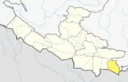
Susta (Nepali: सुस्ता) is a rural municipality located in Parasi District of Lumbini Province of Nepal.[1]
Susta
सुस्ता | |
|---|---|
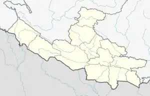
 Susta Location in Nepal  Susta Susta (Nepal) | |
| Coordinates: 27.45°N 83.86°E | |
| Country | |
| Province | Lumbini Province |
| District | Parasi |
| No. of wards | 5 |
| Established | 10 March 2017 |
| Government | |
| • Type | Rural council |
| • Chairperson | Mr. Tek Narayan Uppadhaya |
| • Vice-chairperson | Mrs. Geeta Chaudhary |
| Area | |
| • Total | 91.24 km2 (35.23 sq mi) |
| Population (2011) | |
| • Total | 35,890 |
| • Density | 390/km2 (1,000/sq mi) |
| Time zone | UTC+5:45 (NST) |
| Headquarters | Kudiya |
| Website | sustamun |
The total area of the rural municipality is 91.24 square kilometres (35.23 sq mi) and the total population of the rural municipality as of 2011 Nepal census is 35,890 individuals. The rural municipality is divided into total 5 wards.[2][3]
The rural municipality was established on 10 March 2017, fulfilling the requirement of the new constitution of Nepal in 2015, all old municipalities and villages (which were more than 3900 in number) were restructured into 753 new units, thus this RM came into existence.[4][5][6]
Kudiya, a portion of Tribenisusta, a big portion of Rupauliya, Narsahi and Pakalihawa Village development committees were incorporated to form this new rural municipality. The headquarters of the municipality is situated at Kudiya.[2][7]
Background
The rural municipality was established on 10 March 2017 as named Tribenisusta and it was part of Gandaki Province under Nawalpur District.[7] the area of this municipality was 112.17 square kilometres (43.31 sq mi) and it had population of 43,797 individuals.[2] Soon, the decision was taken to keep it in Lumbini Province under Parasi District but a big portion of Tribenisusta excluded from it and merged to Binayi Tribeni rural municipality of Gandaki Province.
References
- "स्थानीय तहहरुको विवरण" [Details of the local level bodies]. www.mofald.gov.np/en (in Nepali). Ministry of Federal Affairs and Local Development. Retrieved 17 July 2018.
- "District Corrected Last for RAJAPATRA" (PDF). www.mofald.gov.np. Retrieved 17 July 2018.
- "CITY POPULATION – statistics, maps & charts". www.citypopulation.de. 10 August 2017. Retrieved 16 August 2018.
- "New local level structure comes into effect from today". www.thehimalayantimes.com. The Himalayan Times. 10 March 2017. Retrieved 17 July 2018.
- "Govt prepares to add 9 more local levels in Province 2". www.kathmandupost.ekantipur.com. Kantipur Publication. 11 August 2017. Retrieved 15 August 2018.
- "New local level units come into existence". www.kathmandupost.ekantipur.com. 11 March 2017. Retrieved 18 July 2018.
- सुस्ता गाउँपािलका काे परिचय
