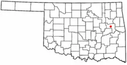
Summit, Oklahoma
Summit is a town in Muskogee County, Oklahoma, United States. It was originally called South Muskogee when it was platted in 1910, and is one of thirteen all-black towns still surviving at the beginning of the 21st Century.[4] The population was 139 at the 2010 census, a 38.5 percent decline from the figure of 226 recorded in 2000.[5]
Summit, Oklahoma | |
|---|---|
 Location of Summit, Oklahoma | |
| Coordinates: 35°40′10″N 95°25′14″W | |
| Country | United States |
| State | Oklahoma |
| County | Muskogee |
| Area | |
| • Total | 0.98 sq mi (2.53 km2) |
| • Land | 0.98 sq mi (2.53 km2) |
| • Water | 0.00 sq mi (0.00 km2) |
| Elevation | 617 ft (188 m) |
| Population (2020) | |
| • Total | 108 |
| • Density | 110.66/sq mi (42.73/km2) |
| Time zone | UTC-6 (Central (CST)) |
| • Summer (DST) | UTC-5 (CDT) |
| FIPS code | 40-71450[3] |
| GNIS feature ID | 2413349[2] |
Geography
According to the United States Census Bureau, the town has a total area of 0.9 square miles (2.3 km2), all land.
Demographics
| Census | Pop. | Note | %± |
|---|---|---|---|
| 1990 | 170 | — | |
| 2000 | 226 | 32.9% | |
| 2010 | 139 | −38.5% | |
| 2020 | 108 | −22.3% | |
| U.S. Decennial Census[6] | |||
As of the census[3] of 2000, there were 226 people, 66 households, and 54 families residing in the town. The population density was 247.8 inhabitants per square mile (95.7/km2). There were 73 housing units at an average density of 80.0 per square mile (30.9/km2). The racial makeup of the town was 84.07% African American, 5.75% White, 3.98% Asian, 1.33% Native American, 0.44% Pacific Islander, and 4.42% from two or more races. Hispanic or Latino of any race were 1.77% of the population.
There were 66 households, out of which 42.4% had children under the age of 18 living with them, 59.1% were married couples living together, 18.2% had a female householder with no husband present, and 16.7% were non-families. 15.2% of all households were made up of individuals, and 10.6% had someone living alone who was 65 years of age or older. The average household size was 3.42 and the average family size was 3.60.
In the town, the population was spread out, with 42.0% under the age of 18, 11.9% from 18 to 24, 18.1% from 25 to 44, 16.4% from 45 to 64, and 11.5% who were 65 years of age or older. The median age was 22 years. For every 100 females, there were 76.6 males. For every 100 females age 18 and over, there were 74.7 males.
The median income for a household in the town was $17,917, and the median income for a family was $15,625. Males had a median income of $16,563 versus $11,875 for females. The per capita income for the town was $6,390. About 34.5% of families and 47.5% of the population were below the poverty line, including 65.2% of those under the age of eighteen and 10.0% of those 65 or over.
Historic Sites
NRHP-listed sites in Summit include:
- W.E.B. DuBois School
- St. Thomas Primitive Baptist Church
- Reverend L.W. Thomas Homestead
See also
- Boley, Brooksville, Clearview, Grayson, Langston, Lima, Redbird, Rentiesville, Taft, Tatums, Tullahassee, and Vernon, other "All-Black" settlements that were part of the Land Run of 1889.[7]
References
- "ArcGIS REST Services Directory". United States Census Bureau. Retrieved September 20, 2022.
- U.S. Geological Survey Geographic Names Information System: Summit, Oklahoma
- "U.S. Census website". United States Census Bureau. Retrieved January 31, 2008.
- Larry O'Dell, "Summit", Encyclopedia of Oklahoma History and Culture. Accessed May 2, 2010.
- CensusViewer: Population of the City of Summit, Oklahoma
- "Census of Population and Housing". Census.gov. Retrieved June 4, 2015.
- O'Dell, Larry. "All-Black Towns". Encyclopedia of Oklahoma History & Culture. Oklahoma Historical Society. Retrieved March 29, 2020.
