Stroet
Stroet is a village in the Dutch province of North Holland. It is a part of the municipality of Schagen, and lies about 11 km north of Heerhugowaard.
Stroet | |
|---|---|
Village | |
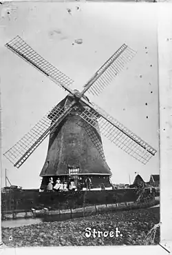 Former windmill | |
 Stroet Location in the Netherlands 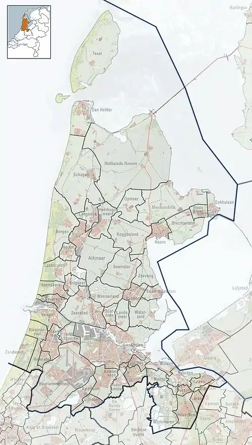 Stroet Location in the province of North Holland in the Netherlands | |
| Coordinates: 52°45′N 4°45′E | |
| Country | Netherlands |
| Province | North Holland |
| Municipality | Schagen |
| Area | |
| • Total | 0.26 km2 (0.10 sq mi) |
| Elevation | −0.7 m (−2.3 ft) |
| Population (2021)[1] | |
| • Total | 315 |
| • Density | 1,200/km2 (3,100/sq mi) |
| Time zone | UTC+1 (CET) |
| • Summer (DST) | UTC+2 (CEST) |
| Postal code | 1744[1] |
| Dialing code | 0224 |
The village was first mentioned in 1343 as Stroeden, and means "soggy area with shrubbery".[3] Stroet used to have a wind mill, but it was demolished in the early 20th century.[4]
References
- "Kerncijfers wijken en buurten 2021". Central Bureau of Statistics. Retrieved 1 May 2022.
- "Postcodetool for 1744EG". Actueel Hoogtebestand Nederland (in Dutch). Het Waterschapshuis. Retrieved 1 May 2022.
- "Stroet - (geografische naam)". Etymologiebank (in Dutch). Retrieved 1 May 2022.
- "Stroet". Plaatsengids (in Dutch). Retrieved 1 May 2022.
This article is issued from Wikipedia. The text is licensed under Creative Commons - Attribution - Sharealike. Additional terms may apply for the media files.