Steenderen
Steenderen is a former municipality and a village in the eastern Netherlands. It has been part of the new municipality of Bronckhorst since 2005.[3]
Steenderen | |
|---|---|
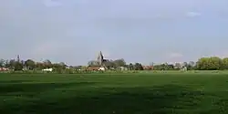
 Steenderen, view to the village with two church towers | |
 Flag  Coat of arms | |
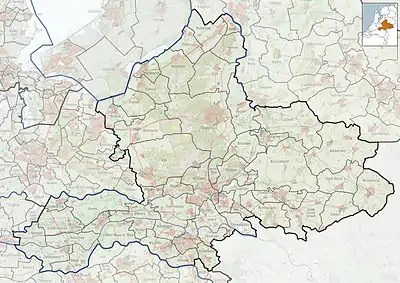
 Steenderen Location in the province of Gelderland  Steenderen Steenderen (Netherlands) | |
| Coordinates: 52°3′52″N 6°11′12″E | |
| Country | Netherlands |
| Province | Gelderland |
| Municipality | Bronckhorst |
| Area | |
| • Total | 50.21 km2 (19.39 sq mi) |
| Elevation | 10 m (30 ft) |
| Population (2021)[1] | |
| • Total | 4,655 |
| • Density | 93/km2 (240/sq mi) |
| Time zone | UTC+1 (CET) |
| • Summer (DST) | UTC+2 (CEST) |
| Postal code | 7221-7229[1] |
| Dialing code | 0575 |
History
It was first mentioned in 1046 as Stenere, and means "stone buildings on a sandy ridge".[4] In 1217, a parish church is established. The Dutch Reformed Church has elements dating from the 14th century. In 1782, it suffered a fire after a lightning strike, and was rebuilt. The church was restored between 1966 and 1972.[5] In 1840, it was home to 486 people.[3]
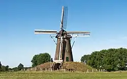
The grist mill Bronkhorstermolen dates from 1844 and was restored in 1960.[5] The potato and chips factory Aviko was founded in Steenderen in 1962. In 2019, a 35 metres (115 ft) refrigerator tower was constructed, giving Steenderen three towers.[3]
Former population centres
- Baak
- Bronkhorst
- Olburgen
- Rha
- Steenderen
- Toldijk
Gallery
 Steenderen, church (de Sint Remigiuskerk) in the street
 Steenderen, church: de Sint Willibrorduskerk
 between Steenderen and Bronkhorst, Bronkhorstermolen
References
- "Kerncijfers wijken en buurten 2021". Central Bureau of Statistics. Retrieved 20 March 2022.
- "Postcodetool for 7221AA". Actueel Hoogtebestand Nederland (in Dutch). Het Waterschapshuis. Retrieved 20 March 2022.
- "Steenderen". Plaatsengids (in Dutch). Retrieved 20 March 2022.
- "Steenderen - (geografische naam)". Etymologiebank (in Dutch). Retrieved 20 March 2022.
- Ronald Stenvert & Sabine Broekhoven (2000). "Steenderen" (in Dutch). Zwolle: Waanders. p. 293. ISBN 90 400 9406 3. Retrieved 20 March 2022.