Steele Township, Rowan County, North Carolina
Steele Township is one of fourteen townships in Rowan County, North Carolina, United States. The township had a population of 1,725 according to the 2010 census.[1]
Steele Township | |
|---|---|
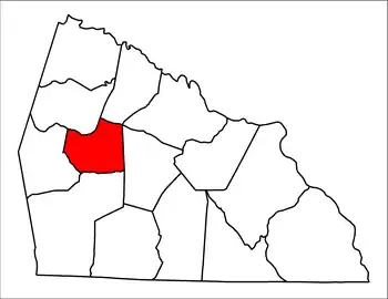
 Location of Steele Township in Rowan County | |
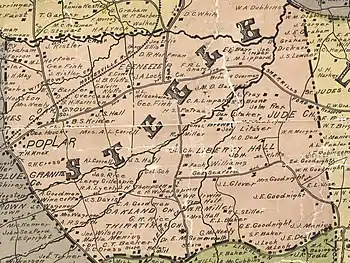
 Steele Township in 1903 | |
| Country | United States |
| State | North Carolina |
| County | Rowan |
| Established in | 1868 |
| Government | |
| • Type | non-functioning county subdivision |
| Area | |
| • Total | 21.97 sq mi (56.9 km2) |
| Population (2010) | |
| • Total | 1,725 |
| Time zone | UTC-5 (Eastern (EST)) |
| • Summer (DST) | UTC-4 (EDT) |
Geography
Steele Township is located in western central Rowan County and occupies 21.97 square miles (56.9 km2). There are no incorporated municipalities in Steele Township.
The northern border of the township follows Beaverdam and Withrow Creeks, NC Hwy 801, and the Norfolk Southern railroad to Second Creek. The eastern border goes along Richard Road and Lowder Road then goes straight down to NC Hwy 150. NC Hwy 150 & Sloan Road make up the southern border of Steele Township. The western border follows Upright Road, Lyerly Road, Graham Road, NC Hwy 801 then goes north & meets with Beaverdam Creek.
Sites of interest
The following churches, historic sites, and villages are located in Steele Township:[2]
- Bear Poplar, since about 1775
- Ebenezer United Methodist Church, established in 1853
- Jude Church
- Kerr Mill, a grist mill built by Dr. Samuel Kerr in 1823, present site of Sloan Park
- Liberty Hall School
- St. Luke's Lutheran Church, established in 1869
- Thyatira Presbyterian Church, founded about 1750
Adjacent townships
References
- "U.S. Census website". United States Census Bureau. Retrieved May 14, 2011.
- Miller, CM (1903). "1903 Map of Rowan County". Retrieved October 3, 2022.
