Saint-Bonnet-le-Château
Saint-Bonnet-le-Château (French: [sɛ̃ bɔnɛ l(ə) ʃɑto]; Occitan: Sant Bonet dau Chastèl) is a commune in the Loire department in central France.[3]
Saint-Bonnet-le-Château
| |
|---|---|
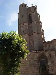 Tower of the collegiate church of Saint-Bonnet | |
.svg.png.webp) Coat of arms | |
Location of Saint-Bonnet-le-Château | |
 Saint-Bonnet-le-Château  Saint-Bonnet-le-Château | |
| Coordinates: 45°25′28″N 4°04′01″E | |
| Country | France |
| Region | Auvergne-Rhône-Alpes |
| Department | Loire |
| Arrondissement | Montbrison |
| Canton | Saint-Just-Saint-Rambert |
| Intercommunality | CA Loire Forez |
| Government | |
| • Mayor (2020–2026) | Patrick Ledieu[1] |
| Area 1 | 1.87 km2 (0.72 sq mi) |
| Population | 1,497 |
| • Density | 800/km2 (2,100/sq mi) |
| Time zone | UTC+01:00 (CET) |
| • Summer (DST) | UTC+02:00 (CEST) |
| INSEE/Postal code | 42204 /42380 |
| Elevation | 779–952 m (2,556–3,123 ft) (avg. 860 m or 2,820 ft) |
| 1 French Land Register data, which excludes lakes, ponds, glaciers > 1 km2 (0.386 sq mi or 247 acres) and river estuaries. | |
Population
|
|
International relations
Saint-Bonnet-le-Château is twinned with:
 Bishop's Waltham, United Kingdom[4]
See also
References
- "Répertoire national des élus: les maires" (in French). data.gouv.fr, Plateforme ouverte des données publiques françaises. 13 September 2022.
- "Populations légales 2020". The National Institute of Statistics and Economic Studies. 29 December 2022.
- INSEE commune file
- "British towns twinned with French towns". Archant Community Media Ltd. Retrieved 11 July 2013.
Wikimedia Commons has media related to Saint-Bonnet-le-Château.
This article is issued from Wikipedia. The text is licensed under Creative Commons - Attribution - Sharealike. Additional terms may apply for the media files.