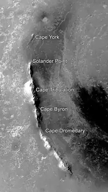
Solander Point
Solander Point is at the north end of the west-southwestern ridgeline of Endeavour crater on the planet Mars. It is named after the Swedish scientist Daniel Solander, who was the first university-educated scientist to set foot on Australian soil at Botany Bay in 1770.

Solander Point was visited in 2013 by the Mars Exploration Rover-B Opportunity, a robotic rover that was active on Mars from 2004-2018. [1]
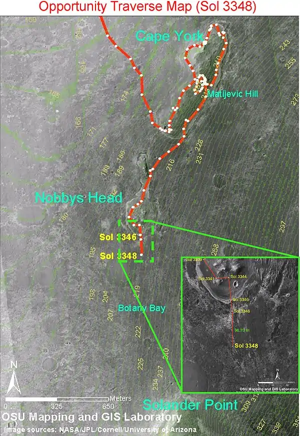
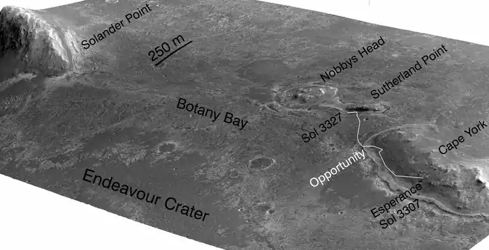
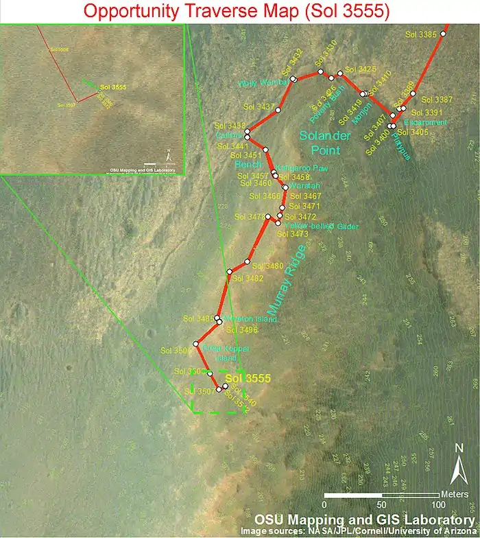
By early July 2013 Opportunity was approaching it from the North, after previously examining outcrops on the northwest edge of the crater, north of Solander.[2] The rover drove south from Cape York through Botany Bay to travel to Solander.[3] By July 2, 2013, it was about half-way there.[3] The area was imaged from Martian orbit by HiRISE on July 8, 2013, data which aids the rover team in understanding the terrain and planning rover traverses.[4] The rover has been making good time on its approach to Solander, giving the opportunity to investigate a curious area of terrain in the crater.[5][6] At the start of August, the rover was less than 100 meters (328 ft) from Solander,[7] and arrived at its base in the following days.[8] Its arrival signaled the availability of a northward facing slope, useful for angling to collect more sunlight during the Martian winter.[8] In October and November 2013, the rover climbed up the north end of Solander.[9] By December 2013, the rover reached the top of Solander point hill as the 10 year anniversary of its landing on Mars neared.[10] After Solander point Opportunity moved along Murray Ridge, and then south to Cape Tribulation.[11]
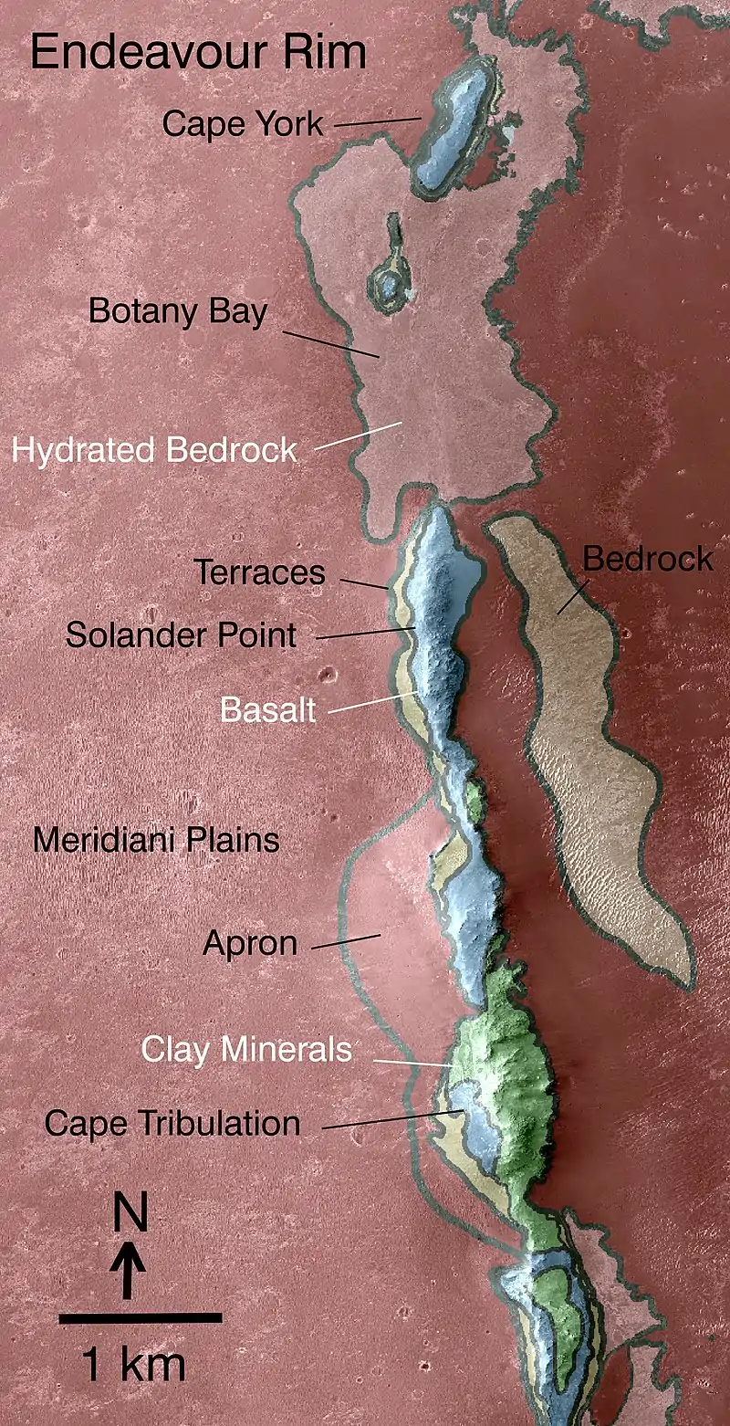
Between Solander Point and, to north of it Cape York, both of which are raised up, is a lower area that is noted to be a part of the Burns Formation.[12] The Burns Formation extends all the way back to Opportunity's landing site by Eagle crater, and it was heavily studied prior to this time by the rover.[13] The Burns Formation is "high in sulfate bearing minerals" according to NASA.[14] Solander Point lies at the geological contact line between the Burns Formation, and what is thought to be an even older geological region.[15]
Solander point
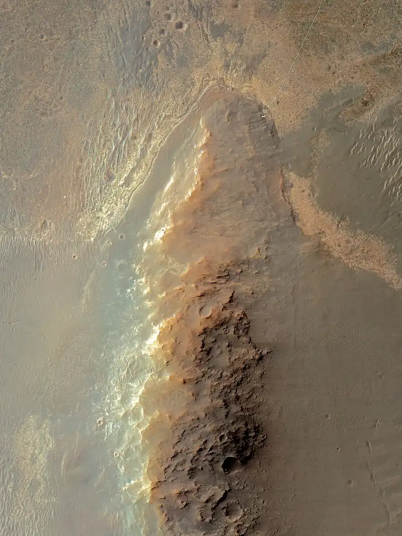
Map showing journey of MER-B near Solander Point
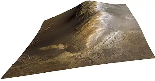
Geological regions around Solander
Rover views of Solander


References
- Mars Rover Opportunity Approaches Solander Point By Keith Cowing
- "NASA - Sol 3351". Archived from the original on 2014-06-20. Retrieved 2013-07-15.
- Mars Rover Opportunity Passes Half-Way Point to Next Destination
- Overhead View of Mars Rover 10 Years After Launch - NASA
- The Planetary Society: L. Crumpler - Field Report From Mars: Sol 3363 - July 10, 2013
- Field Notes from Mars: Sol 3363 - July 10, 2013 Archived October 23, 2013, at the Wayback Machine
- August 2, 2013 NNM Archived October 21, 2013, at the Wayback Machine August 2, 2013 TPS
- "NASA - Sol 33591". Archived from the original on 2014-06-20. Retrieved 2013-08-13.
- NASA -Mars Rover Opportunity Heads Uphill
- "Opportunity Rover Starts 2nd Decade by Spectacular Mountain Summit and Mineral Goldmine - Universe Today". Universe Today. 2014-01-19. Retrieved 2018-02-09.
- mars.nasa.gov. "Mars Exploration Rover". mars.nasa.gov. Retrieved 2018-02-09.
- "Mars Rover Opportunity Working at Edge of 'Solander'". NASA/JPL. Retrieved 2018-02-09.
- "Mars Rover Opportunity Working at Edge of 'Solander'". NASA/JPL. Retrieved 2018-02-09.
- "Mars Rover Opportunity Working at Edge of 'Solander'". NASA/JPL. Retrieved 2018-02-09.
- "Mars Rover Opportunity Working at Edge of 'Solander'". NASA/JPL. Retrieved 2018-02-09.
External links
- Opportunity Heads Toward Next Destination, 'Solander Point' - NASA
- Mars Rover Opportunity Trekking Toward More Layers - NASA (June 7, 2013)
- Gallery
- View From Orbit Showing Opportunity in 'Botany Bay' (view includes Solander Point)
- HRSC - Western ridge of Endeavour
- The Road To Endeavour - July 19, 2013
- The Planetary Society - Field Report From Mars: Sol 3378 - July 25, 2013
- Westward view
- Animation at The Planetary Society
- K. Kremer - "NASA’s Resilient Opportunity Rover Starts Martian Mountaineering" - Universe Today
- Traverse map on Sol 3600(March 14, 2014)
- A view of Solander Point from Botany Bay
Features on Mars visited by Opportunity | ||
|---|---|---|
| Craters | ||
| Endeavour | ||
| Rocks (list) | ||