Slopná
Slopná (Hungarian: Szolopna) is a village and municipality in Považská Bystrica District in the Trenčín Region of north-western Slovakia.
Slopná | |
|---|---|
Municipality | |
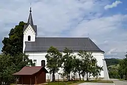 St. Andrew's Church | |
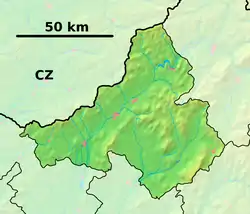 Slopná Location of Slopná in the Trenčín Region 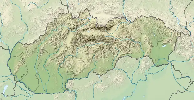 Slopná Slopná (Slovakia) | |
| Coordinates: 49°03′N 18°24′E | |
| Country | Slovakia |
| Region | Trenčín |
| District | Považská Bystrica |
| First mentioned | 1277 |
| Area | |
| • Total | 7.64[1] km2 (2.95[1] sq mi) |
| Elevation | 309[2] m (1,014[2] ft) |
| Population (2021) | |
| • Total | 487[3] |
| Postal code | 018 21[2] |
| Area code | +421 42[2] |
| Car plate | PB |
| Website | www.slopna.sk |
History
In historical records the village was first mentioned in 1277.
Geography
The municipality lies at an altitude of 310 metres and covers an area of 7.642 km2. It has a population of about 491 people.
References
- "Hustota obyvateľstva - obce [om7014rr_ukaz: Rozloha (Štvorcový meter)]". www.statistics.sk (in Slovak). Statistical Office of the Slovak Republic. 2022-03-31. Retrieved 2022-03-31.
- "Základná charakteristika". www.statistics.sk (in Slovak). Statistical Office of the Slovak Republic. 2015-04-17. Retrieved 2022-03-31.
- "Počet obyvateľov podľa pohlavia - obce (ročne)". www.statistics.sk (in Slovak). Statistical Office of the Slovak Republic. 2022-03-31. Retrieved 2022-03-31.
External links
![]() Media related to Slopná at Wikimedia Commons
Media related to Slopná at Wikimedia Commons
Municipalities of Považská Bystrica District | ||
|---|---|---|
This article is issued from Wikipedia. The text is licensed under Creative Commons - Attribution - Sharealike. Additional terms may apply for the media files.