Silvermines
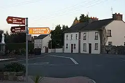
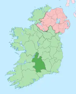
Silvermines, historically known as Bellagowan[2] (Irish: Béal Átha Gabhann), is a village in County Tipperary in Ireland. It lies immediately north of the Silvermine mountain range and takes its name from the extensive mines of lead, zinc, copper, baryte and silver nearby. Towards the very south of the Silvermine Mountains is the highest peak in the mountains, Keeper Hill or in Irish Sliabh Cimeálta, which rises to 695m, dominating the area. Silvermines is located near the town of Nenagh on the R499 regional road. It is a parish in the Roman Catholic Diocese of Killaloe[3] and is also in the historical barony of Ormond Upper.
Silvermines
Irish: Béal Átha Gabhann | |
|---|---|
Village | |
 Silvermines village at dusk. | |
 Silvermines Location in Ireland | |
| Coordinates: 52°47′35″N 8°14′13″W | |
| Country | Ireland |
| Province | Munster |
| County | County Tipperary |
| Population | 310 |
| Time zone | UTC+0 (WET) |
| • Summer (DST) | UTC-1 (IST (WEST)) |
| Irish Grid Reference | R840713 |
Mining heritage

The earliest record of mining in the district is from 1289, but was short-lived. Mining resumed in the 17th century and continued intermittently until 1874. It restarted in 1949, and shortly after a world-class deposit of baryte was found and opencast mining of this began in 1963 by Magcobar (Ireland) Ltd. Soon after a multi-million-tonne orebody grading about 11% combined lead and zinc was also discovered. This was worked underground from 1968 to 1982 by Mogul of Ireland Ltd. The Magcobar mine closed in September 1992, and its extensive spoil heaps are a prominent local landmark, visible for miles. The Mogul mine became famous for the many fine mineral specimens it produced, particularly of the ore minerals galena and sphalerite.[4]
The Old Smelting House, now a ruin, is listed as a protected structure by Tipperary County Council (RPS Ref S477).[5]
Recently, the area has come to media attention as the integrity of the village's water supply was threatened by pollution from the tailings left behind at the mine.
Transport
Freight trains no longer serve Silvermines.
Bus Éireann route 323 from Newport, County Tipperary to Nenagh serves the village on Fridays-only. There is a journey at 11.00 am to Nenagh. This returns from Nenagh railway station at 1.45 pm, serving the village at 2.05 pm and continuing to Newport.[6]
Slieve Felim Way
The Slieve Felim Way, a 43 kilometres (27 miles) long-distance trail through the Silvermine and Slieve Felim Mountains has a trail-head in the village. It is designated as a National Waymarked Trail by the National Trails Office of the Irish Sports Council and is managed by Shannon Development and Coillte.[7]
References
- "Sapmap Area - Settlements - Silvermines". Census 2016. CSO. April 2016. Archived from the original on 25 September 2021. Retrieved 20 October 2019.
- "Bunachar Logainmneacha na hÉireann". Logainm.ie. Retrieved 4 November 2021.
- "Parishes of Killaloe Diocese". Archived from the original on 27 February 2010. Retrieved 4 November 2021.
- Moreton, S. (1999) The Silvermines District, County Tipperary, Ireland. Mineralogical Record, vol. 30, p.99-106
- "NTCC Register of Protected Structures" (PDF). Archived from the original (PDF) on 30 January 2015. Retrieved 4 November 2021.
- "Archived copy" (PDF). Archived from the original (PDF) on 12 April 2012. Retrieved 2 January 2012.
{{cite web}}: CS1 maint: archived copy as title (link) - National Trails Office 2010, p. 43.
