Shire of Jondaryan
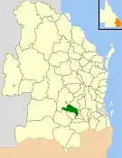
The Shire of Jondaryan was a local government area located in the Darling Downs region of Queensland, Australia, immediately west of the regional city of Toowoomba. The shire, administered from the town of Oakey, covered an area of 1,910.0 square kilometres (737.5 sq mi), and existed as a local government entity from 1890 until 2008, when it amalgamated with several other councils in the Toowoomba area to form the Toowoomba Region. Its growth in later years has been fuelled by the expansion of Toowoomba and suburbs such as Glenvale and Westbrook.
| Shire of Jondaryan Queensland | |||||||||||||||
|---|---|---|---|---|---|---|---|---|---|---|---|---|---|---|---|
 Location within Queensland | |||||||||||||||
| Population | 13,965 (2006 census)[1] | ||||||||||||||
| • Density | 7.3115/km2 (18.9367/sq mi) | ||||||||||||||
| Established | 1890 | ||||||||||||||
| Area | 1,910.0 km2 (737.5 sq mi) | ||||||||||||||
| Council seat | Oakey | ||||||||||||||
| Region | Darling Downs | ||||||||||||||
 | |||||||||||||||
History

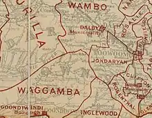
Jondaryan Division was created on 11 November 1879 as one of 74 divisions around Queensland under the Divisional Boards Act 1879 with a population of 1738.[2] The divisional offices were located in Toowoomba, Queensland, outside of the division.
With the passage of the Local Authorities Act 1902, Jondaryan Division became Shire of Jondaryan on 31 March 1903. Until 1960, the Shire's offices were located at Snell and Russell Streets, Toowoomba. Many of the council's original staff and councillors were associated with the Jondaryan Estates pastoral empire.
On 25 January 1913, the Shire of Gowrie was abolished and was split between the new Town of Newtown and the Shire of Jondaryan.[3][4]
On 24 April 1913 the Millmerran and Pittsworth areas to its southwest seceded from the Shire of Jondaryan and separately incorporated as shires.[5]
On 23 Feb 1917, the Town of Newtown was abolished, being split between the City of Toowoomba and the Shire of Jondaryan.[4]
On 19 March 1949, Jondaryan received part of the former Shire of Drayton when it was abolished.[6][7]
In 1960, the Shire's headquarters moved from Toowoomba (outside the shire) to the town of Oakey (within the shire).
On 15 March 2008, under the Local Government (Reform Implementation) Act 2007 passed by the Parliament of Queensland on 10 August 2007, the Shire of Jondaryan merged with the City of Toowoomba and the Shires of Cambooya, Clifton, Crows Nest, Millmerran, Pittsworth and Shire of Rosalie to form the Toowoomba Region.
Towns and localities
The Shire of Jondaryan includes the following settlements:
- Oakey
- Athol
- Aubigny
- Bowenville1
- Charlton1
- Cotswold Hills1
- Evanslea
- Glenvale2
- Gowrie Junction1, 2
- Gowrie Mountain
- Grassdale
- Jondaryan
- Kingsthorpe1
- Torrington2
- Wyreema3
1 - split with the former Shire of Rosalie
2 - split with the former City of Toowoomba
3 - split with the former Shire of Cambooya
Population
| Year | Population |
|---|---|
| 1933 | 5,231 |
| 1947 | 5,346 |
| 1954 | 5,416 |
| 1961 | 5,785 |
| 1966 | 5,752 |
| 1971 | 5,704 |
| 1976 | 6,576 |
| 1981 | 7,832 |
| 1986 | 9,457 |
| 1991 | 10,308 |
| 1996 | 11,056 |
| 2001 | 12,323 |
| 2006 | 13,965 |
Chairmen and mayors
The Jondaryan Division and Shire had the following leaders:[8]
Chairmen of Jondaryan Division
- 1880-1892: James Taylor[9]
- 1892-1894: Francis Gore
- 1894-1896: Gilbert Cory
- 1896-1919: Charles Campbell
Chairmen of Jondaryan Shire
- 1896-1919: Charles Campbell
- 1919-1945: William Kent
- 1945-1955: Alan Paull
- 1955-1959: Ernest Janetzki
- 1959-1972: John Corfe
- 1972-1973: Thomas Meehan
- 1973-1985: Ian McIntyre
- 1985-2008: Peter Taylor (mayor from 1993)
Peter Taylor was Jondaryan's final mayor, serving from 1985 until 2008. At the time of his first election he was the youngest Shire Chairman in Queensland. On 15 March 2008 he became the first mayor of the new Toowoomba Regional Council with 71.19% of the vote.[10] Taylor was an executive member (Director) of the Local Government Association of Queensland (LGAQ) representing the Darling Downs, and was also director of the Board of LG Super, a statewide superannuation fund for all local government employees.
References
- Australian Bureau of Statistics (25 October 2007). "Jondaryan (S) (Local Government Area)". 2006 Census QuickStats. Retrieved 18 March 2008.
- "Proclamation [Jondaryan Division]". Queensland Government Gazette. 11 November 1879. p. 25:995.
- "Agency ID 912, Gowrie Shire Council". Queensland State Archives. Retrieved 10 September 2013.
- "Agency ID 1449, Newtown Town Council". Queensland State Archives. Retrieved 10 September 2013.
- "DIVIDING THE DOWNS". The Brisbane Courier. National Library of Australia. 29 April 1913. p. 7. Retrieved 10 September 2013.
- Jondaryan Shire Council (11 March 2008). "Last Meeting of Jondaryan Shire Council". Archived from the original on 19 July 2008. Retrieved 2 April 2008.
- "Untitled". Queensland Government Gazette. 17 March 1949. p. 172:981–985.
- "Jondaryan Shire Past Chairmen and Mayors". Toowoomba Regional Council. Archived from the original on 22 February 2014. Retrieved 30 January 2014.
- "QUEENSLAND NEWS". The Brisbane Courier. National Library of Australia. 11 February 1888. p. 6. Retrieved 4 October 2013.
- Searle, Susan (17 March 2008). "Overwhelming win humbles Taylor". Toowoomba Chronicle. Archived from the original on 21 July 2008. Retrieved 2 April 2008.