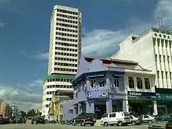
Segamat (town)
Segamat (Jawi: سڬامت Chinese: 昔加末) is a town located in the Segamat District, Johor, Malaysia.
Segamat سڬامت 昔加末 | |
|---|---|
Town and district capital | |
 | |
|
Coat of arms | |
| Country | |
| State | |
| District | Segamat District |
| Granted municipality status | 1 January 2018 |
| Government | |
| • Type | Local government |
| • Body | Segamat Municipal Council |
| • President | Ungku Mohd Tahir Ungku Mohd Zakaria |
| Area | |
| • Total | 269 km2 (104 sq mi) |
| Population (2010)[1] | |
| • Total | 92,000 |
| • Density | 340/km2 (890/sq mi) |
| Postcode | 85xxx |
| Telephone area code | +60-07 |
| Vehicle registration | J |
| Website | mpsegamat |
Segamat Municipal Council Majlis Perbandaran Segamat مجليس ڤربندرن سڬامت | |
|---|---|
| Type | |
| Type | |
| History | |
| Founded | 1 January 2018 |
| Preceded by | Segamat District Council |
| Leadership | |
President | Ungku Mohd Tahir Ungku Mohd Zakaria |
Municipal Secretary | Muhammad Yusof Md Esa |
| Motto | |
| Khidmat Untuk Rakyat/خدمت اونتوق رعيت (Serve the People) | |
| Meeting place | |
| No 1, Jalan Abdullah, 85000 Segamat, Johor Darul Ta'zim | |
| Website | |
| mpsegamat | |
History
In 1933, the district of Segamat was formed after a major district boundary realignment was made by the government of Johor to split the original 4 districts (Muar, Batu Pahat, Johor Bahru and Sedili) into 8 districts (before the 2008 realignment which added the Kulai and Tangkak districts to form 10 districts in Johor).
After the formation of Segamat District, the government began to develop Segamat, mainly with agricultural activities to boost the economy of Segamat. This included the construction of the national railroad system passing the town of Segamat and also the construction of the main road known today as Federal Route 1.
In the 1970s, Tun Razak Highway was constructed to boost the economy of Segamat as an agricultural hub, to shorten the travelling time to Kuantan and to speed up the development progress of the poorly developed areas in southern Pahang.
The Johor branch campus of Universiti Teknologi MARA was constructed at Jementah in the end of the 1980s and started its operation in 1991. The construction of UiTM campus in Segamat district turned Segamat into another important educational hub in Johor besides Skudai, which houses Universiti Teknologi Malaysia.
In 1996, the Segamat Land Port was constructed to make Segamat an important transport hub like Nilai, Negeri Sembilan. By constructing the land port, manufacturers may just transport their goods to Segamat Land Port which then will be transported to the nearest sea ports such as Pasir Gudang by train. However, the plan did not materialise as planned; the space was subsequently rendered largely vacant as of latest February 2012.
In 1999, the second bridge of Segamat, funded mainly by private developers, was constructed to reduce congestion at the main bridge. The second bridge was included as a part of Segamat Inner Ring Road package consisting the road upgrade to 4-lane road at Jalan Pemuda, Jalan Hassan, Jalan Pee Kang Hai and Jalan Chia Chin Koon, which was completed in August 2005. The inner ring road package is useful to divert the traffic flow when the main roads at the town center are closed for special occasions and events such as National Day.
Segamat experienced floods during the 1950s, 1984 , 18 December 2006 and most recently 2nd March 2023, which was caused by 3-4 days of nonstop rain. The one in 2006, which was caused by Typhoon Utor in the Philippines, was generally considered to be the worst flood to have happened in Segamat and Johor.
Government and politics
Segamat Municipal Council (Malay: Majlis Perbandaran Segamat), formerly known as the Segamat Town Board (Malay: Lembaga Bandaran Segamat) from 1912 until 1951, Segamat Town Council (Malay: Majlis Bandaran Segamat) from 1951 until 1976, the North Segamat District Council (Malay: Majlis Daerah Segamat Utara) from 1 January 1977 until 29 November 2000 and the Segamat District Council (Malay: Majlis Daerah Segamat from 30 November 2000 until 31 December 2017, is the local authority of Segamat town.[2][3]
Notable people
References
- "Latar Belakang | Portal Rasmi Majlis Daerah Segamat (MDS)". mdsegamat.gov.my. Retrieved 26 November 2017.
- "Local Authorities Should Function As A Government - Khaled". Archived from the original on 1 January 2018.
{{cite web}}: CS1 maint: unfit URL (link) - "Latar Belakang".
External links
- Segamat.com.my - Segamat Community Website
- YM Ungku Mohd. Zaman bin Tahir (1996). Segamat: Sejarah dan Mitosnya. Al-Kafilah Enterprise.
- Segamat District Council official website
| |||||||||||||||
| General topics |
|  | |||||||||||||
| Administrative divisions |
| ||||||||||||||
| City councils (Majlis Bandaraya) |
| ||||||||||||||
| Municipal councils (Majlis Perbandaran) |
| ||||||||||||||
| District councils (Majlis Daerah) |
| ||||||||||||||
| |||||||||||||||