Salang Pass
The Salang Pass (Pashto: د سالنګ لاره; Dari: كتل سالنگ Kutal-i Salang, el. 3,878 m or 12,723 ft) is the primary mountain pass connecting northern Afghanistan with Parwan Province, with onward connections to Kabul Province, southern Afghanistan, and to the Pakistani province of Khyber Pakhtunkhwa.[1] Located on the border of Parwan Province and Baghlan Province, it is just to the East of the Kushan Pass, and both of them were of great importance in early times as they provided the most direct connections between the Kabul region with northern Afghanistan or Tokharistan. The Salang River originates nearby and flows south.
| Salang Pass | |
|---|---|
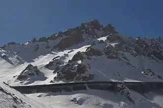
 Salang tunnel view from the side | |
| Elevation | 3,878 m (12,723 ft) |
| Location | Afghanistan |
| Range | Hindu Kush |
| Coordinates | 35°18′49.44″N 69°02′13.51″E |
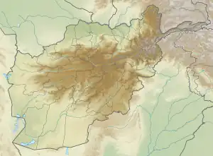
 | |
The pass crosses the Hindu Kush mountains but is now bypassed through the Salang Tunnel, which runs underneath it at a height of about 3,400 m. The tunnel was built by engineers and construction crews from the Soviet Union in 1958 – 1964 as part of a wide-ranging infrastructure build out in Afghanistan carried out by the USSR. During the Afghan civil war it was blown up in 1997 by forces of Ahmad Shah Massoud in order to prevent Taliban fighters from coming through it. In 2002 the Russian Ministry Of Emergency Situations (RMES) organized the work to rebuild the tunnel and the repairs were completed within a month.[2]
It links Charikar and Kabul in the South with Mazar-i-Sharif and Kunduz in the North. Before the road and tunnel were built, the main route between Kabul and northern Afghanistan was via the Shibar Pass, a much longer route which took three days.[1]
The road through the pass has carried heavy military traffic in recent conflicts and is in very bad repair.[1]
February 2010 avalanches
On February 9, 2010, the pass was hit by multiple avalanches.[3][4] According to press reports the road through the pass was hit by 17 avalanches, killing dozens, burying miles of highway, and trapping the vehicles in the Salang tunnel. By February 10, 2010, authorities had recovered over 160 bodies.[5] Radio Free Europe reported the first avalanche blocked the tunnel, and trapped vehicles in a traffic jam in a "deadly avalanche zone".
Gallery
 Salang Pass view
 The Salang Pass with heavy snow on 30 January 2009
 On the way to Salang Pass
 Salang pass view
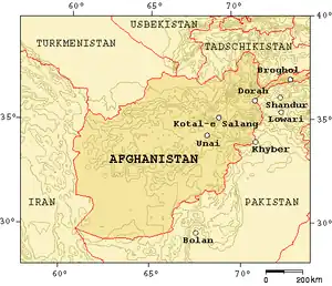
 Map showing mountain passes of Afghanistan
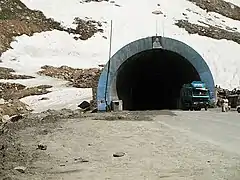
 Entrance to Salang pass tunnel
See also
References
- Library of Congress Country Study: Afghanistan Chapter 2: Mountains
- Newsru. Jan 19 2002. Salang Pass reopened again
- Rod Norland (2010-02-09). "Avalanches Kill Dozens on Mountain Highway in Afghanistan". New York Times. Retrieved 2010-02-10.
Heavy winds and rain set off 17 avalanches that buried more than two miles of highway at a high-altitude pass in the Hindu Kush mountain range, entombing hundreds of cars and cutting off Kabul's heavily traveled link to northern Afghanistan, officials said Tuesday.
- Rahim Faiez (2010-02-09). "Avalanches swamp Afghan pass: Scores of bodies pulled from cars as coalition joins search for injured". Toronto Star. Retrieved 2010-02-10.
A series of avalanches engulfed a mountain pass in Afghanistan, trapping hundreds of people in their buried cars and killing at least 24 people, authorities said Tuesday.
- Ahmed Hanayesh, Ron Synovitz (2010-02-10). "From Afghan Avalanche, Tales Of Tragedy And Survival". Radio Free Europe/Radio Liberty. Retrieved 2010-02-10.
By the evening of February 10, authorities had recovered the bodies of more than 160 victims buried by a series of avalanches. The stories told to RFE/RL by survivors suggest the death toll could rise as search teams continue their work -- and when the spring thaw reveals the full extent of the tragedy. The first avalanche blocked the highway just south of the Salang Tunnel. As the traffic began to pile up, travelers in cars, trucks, and buses found themselves trapped in a deadly avalanche zone. Then, one after another, as many as 16 more avalanches wiped their vehicles off the road.
External links
- "Salang Pass". Google Earth.

