Saint-Léger-de-Montbrun
Saint-Léger-de-Montbrun (French pronunciation: [sɛ̃ leʒe də mɔ̃bʁœ̃]) is a commune in the Deux-Sèvres department in western France.
Saint-Léger-de-Montbrun | |
|---|---|
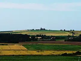 A general view of Saint-Léger-de-Montbrun | |
.svg.png.webp) Coat of arms | |
Location of Saint-Léger-de-Montbrun | |
 Saint-Léger-de-Montbrun  Saint-Léger-de-Montbrun | |
| Coordinates: 46°59′32″N 0°06′59″W | |
| Country | France |
| Region | Nouvelle-Aquitaine |
| Department | Deux-Sèvres |
| Arrondissement | Bressuire |
| Canton | Le Val de Thouet |
| Intercommunality | Thouarsais |
| Government | |
| • Mayor (2020–2026) | Jean-Paul Montibert[1] |
| Area 1 | 30.72 km2 (11.86 sq mi) |
| Population | 1,260 |
| • Density | 41/km2 (110/sq mi) |
| Time zone | UTC+01:00 (CET) |
| • Summer (DST) | UTC+02:00 (CEST) |
| INSEE/Postal code | 79265 /79100 |
| Elevation | 46–105 m (151–344 ft) (avg. 77 m or 253 ft) |
| 1 French Land Register data, which excludes lakes, ponds, glaciers > 1 km2 (0.386 sq mi or 247 acres) and river estuaries. | |
References
- "Répertoire national des élus: les maires". data.gouv.fr, Plateforme ouverte des données publiques françaises (in French). 2 December 2020.
- "Populations légales 2020". The National Institute of Statistics and Economic Studies. 29 December 2022.
Wikimedia Commons has media related to Saint-Léger-de-Montbrun.
This article is issued from Wikipedia. The text is licensed under Creative Commons - Attribution - Sharealike. Additional terms may apply for the media files.