Saint-Fiacre-sur-Maine
Saint-Fiacre-sur-Maine (French pronunciation: [sɛ̃ fjakʁ syʁ mɛn] ⓘ, literally Saint-Fiacre on Maine; Breton: Sant-Fieg-ar-Mewan) is a commune in the Loire-Atlantique department in western France.[3]
Saint-Fiacre-sur-Maine | |
|---|---|
Commune | |
 | |
.svg.png.webp) Coat of arms | |
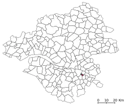
Location of Saint-Fiacre-sur-Maine | |
 Saint-Fiacre-sur-Maine  Saint-Fiacre-sur-Maine | |
| Coordinates: 47°08′39″N 1°24′56″W | |
| Country | France |
| Region | Pays de la Loire |
| Department | Loire-Atlantique |
| Arrondissement | Nantes |
| Canton | Vertou |
| Intercommunality | CA Clisson Sèvre et Maine Agglo |
| Government | |
| • Mayor (2020–2026) | Danièle Gadais[1] |
| Area 1 | 5.97 km2 (2.31 sq mi) |
| Population | 1,236 |
| • Density | 210/km2 (540/sq mi) |
| Time zone | UTC+01:00 (CET) |
| • Summer (DST) | UTC+02:00 (CEST) |
| INSEE/Postal code | 44159 /44690 |
| Elevation | 2–53 m (6.6–173.9 ft) (avg. 53 m or 174 ft) |
| 1 French Land Register data, which excludes lakes, ponds, glaciers > 1 km2 (0.386 sq mi or 247 acres) and river estuaries. | |
The inhabitants are Fiacrais.
Situated near Nantes, Saint-Fiacre is surrounded by Muscadet vineyards, between the rivers Sèvre Nantaise and Maine.
Geography
Saint-Fiacre-Sur-Maine in Loire-Atlantique
- More of 80% of this commune is covered in vines, more than any other in France. There are more than 30 vine growers.
- The communes bordering Saint-Fiacre-sur-Maine are: Vertou, La Haie-Fouassière, Château-Thébaud and Maisdon-sur-Sèvre.
History
Saint-Hilaire-du-Coing (Sanctus Hilarius del Cugno), was founded in the 6th century, becoming Saint-Fiacre-du-Coing (and Saint-Fiacre) in the 16th century because of pilgrimages to view the saint's statue.
Twin towns
Saint Fiacre sur Maine has a town twinning agreement with
 Echichens (Switzerland) since 1977
Population
| Year | Pop. | ±% |
|---|---|---|
| 1962 | 636 | — |
| 1968 | 651 | +2.4% |
| 1975 | 761 | +16.9% |
| 1982 | 935 | +22.9% |
| 1990 | 935 | +0.0% |
| 1999 | 996 | +6.5% |
| 2007 | 1,147 | +15.2% |
| 2017 | 1,207 | +5.2% |
References
- "Répertoire national des élus: les maires" (in French). data.gouv.fr, Plateforme ouverte des données publiques françaises. 13 September 2022.
- "Populations légales 2020". The National Institute of Statistics and Economic Studies. 29 December 2022.
- INSEE commune file
External links
Wikimedia Commons has media related to Saint-Fiacre-sur-Maine.
This article is issued from Wikipedia. The text is licensed under Creative Commons - Attribution - Sharealike. Additional terms may apply for the media files.