Sagehen Creek Field Station
Sagehen Creek Field Station is a research and teaching facility of the University of California at Berkeley's Office of the Vice Chancellor for Research, the Berkeley Natural History Museums & the University of California Natural Reserve System. Sagehen is also a member of the Organization of Biological Field Stations.
| Sagehen Creek Field Station | |
|---|---|
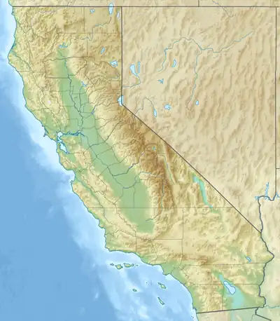  | |
| Location | Nevada County, California |
| Coordinates | 39°25′57″N 120°14′13″W |
| Governing body | University of California, Berkeley |
| Website | http://sagehen.ucnrs.org/ |
The Station was established in 1951 with the signing of a long-term special use permit with the USDA Forest Service; today, this relationship includes the Tahoe National Forest which manages the land, & the Pacific Southwest Research Station, which created the Sagehen Experimental Forest on 28 Nov. 2005.
Sagehen serves as the hub of a much broader network of research areas known as the Central Sierra Field Research Stations.[1] CSFRS consists of:
- Sagehen Creek Field Station
- Central Sierra Snow Laboratory
- Onion Creek Experimental Watershed
- Chickering American Reserve
- North Fork Association Lands
The Station is not generally open to the public. However, Sagehen hosts periodic public events.[2]
Sagehen also maintains a public news blog[3] and video log.[4]
Climate
Sagehen Creek has a continental Mediterranean climate (Köppen Dsb) with subarctic climate (Köppen Dfc) characteristics.
| Climate data for Sagehen Creek, California, 1991–2020 normals: 6337ft (1932m) | |||||||||||||
|---|---|---|---|---|---|---|---|---|---|---|---|---|---|
| Month | Jan | Feb | Mar | Apr | May | Jun | Jul | Aug | Sep | Oct | Nov | Dec | Year |
| Average high °F (°C) | 40.1 (4.5) |
40.5 (4.7) |
48.3 (9.1) |
52.9 (11.6) |
62.0 (16.7) |
71.8 (22.1) |
79.8 (26.6) |
79.2 (26.2) |
72.6 (22.6) |
61.4 (16.3) |
49.4 (9.7) |
38.8 (3.8) |
58.1 (14.5) |
| Daily mean °F (°C) | 27.7 (−2.4) |
27.7 (−2.4) |
33.4 (0.8) |
37.5 (3.1) |
45.1 (7.3) |
52.2 (11.2) |
58.4 (14.7) |
57.3 (14.1) |
51.6 (10.9) |
42.9 (6.1) |
34.8 (1.6) |
26.5 (−3.1) |
41.3 (5.2) |
| Average low °F (°C) | 15.4 (−9.2) |
14.9 (−9.5) |
18.5 (−7.5) |
22.1 (−5.5) |
28.2 (−2.1) |
32.5 (0.3) |
37.0 (2.8) |
35.3 (1.8) |
30.6 (−0.8) |
24.5 (−4.2) |
20.1 (−6.6) |
14.3 (−9.8) |
24.5 (−4.2) |
| Average precipitation inches (mm) | 5.02 (128) |
5.16 (131) |
4.43 (113) |
2.10 (53) |
1.56 (40) |
0.48 (12) |
0.29 (7.4) |
0.44 (11) |
0.60 (15) |
1.81 (46) |
3.02 (77) |
5.63 (143) |
30.54 (776.4) |
| Source 1: NOAA[5] | |||||||||||||
| Source 2: NOAA (Precipitation)[6] | |||||||||||||
References
- "Central Sierra Field Research Stations". The Regents of the University of California. Archived from the original on 18 July 2011. Retrieved 1 July 2011.
- "Sagehen Events". The Regents of the University of California. Retrieved 2 December 2010.
- "Sagehen News". The Regents of the University of California. Retrieved 1 July 2011.
- "Sagehen TV". The Regents of the University of California. Retrieved 1 July 2011.
- "Sagehen Creek, California 1991-2020 Monthly Normals". Retrieved 8 October 2023.
- "Independence Creek, California 1991-2020 Monthly Normals". Retrieved 8 October 2023.