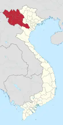
Sông Mã district
Sông Mã is a rural district of Sơn La province in northwest Vietnam. As of 2019, the district had a population of 154,224.[1] The district covers an area of 1,658 km2. Sông Mã is the district capital.[2]
Sông Mã District
Huyện Sông Mã | |
|---|---|
Interactive map outlining Sông Mã District | |
| Coordinates: 21.000°N 103.667°E | |
| Country | Vietnam |
| Region | Northwest |
| Province | Sơn La |
| Capital | Sông Mã |
| Subdivision | one township and 18 rural communes |
| Government | |
| • Type | District |
| Area | |
| • Total | 1,658 km2 (640 sq mi) |
| Population (2019)[1] | |
| • Total | 154,224 |
| • Density | 93/km2 (240/sq mi) |
| Time zone | UTC+7 (ICT) |
| Website | songma |
Administrative divisions
Sông Mã is divided into 19 commune-level sub-divisions, including the township of Sông Mã and 18 rural communes (Bó Sinh, Chiềng Cang, Chiềng En, Chiềng Khoong, Chiềng Khương, Chiềng Phung, Chiềng Sơ, Đứa Mòn, Huổi Một, Mường Cai, Mường Hung, Mường Lầm, Mường Sai, Nà Nghịu, Nậm Mằn, Nậm Ty, Pú Bẩu, Yên Hưng).
Climate
| Climate data for Sông Mã | |||||||||||||
|---|---|---|---|---|---|---|---|---|---|---|---|---|---|
| Month | Jan | Feb | Mar | Apr | May | Jun | Jul | Aug | Sep | Oct | Nov | Dec | Year |
| Average high °C (°F) | 23.9 (75.0) |
26.5 (79.7) |
29.8 (85.6) |
32.5 (90.5) |
33.3 (91.9) |
32.3 (90.1) |
31.6 (88.9) |
31.6 (88.9) |
31.5 (88.7) |
29.7 (85.5) |
27.0 (80.6) |
24.2 (75.6) |
29.5 (85.1) |
| Daily mean °C (°F) | 16.8 (62.2) |
18.6 (65.5) |
21.7 (71.1) |
24.8 (76.6) |
26.4 (79.5) |
26.6 (79.9) |
26.3 (79.3) |
26.0 (78.8) |
25.3 (77.5) |
23.2 (73.8) |
19.9 (67.8) |
16.8 (62.2) |
22.7 (72.9) |
| Average low °C (°F) | 12.5 (54.5) |
13.7 (56.7) |
16.3 (61.3) |
19.5 (67.1) |
21.9 (71.4) |
23.2 (73.8) |
23.2 (73.8) |
22.9 (73.2) |
21.8 (71.2) |
19.5 (67.1) |
16.0 (60.8) |
12.7 (54.9) |
18.6 (65.5) |
| Average precipitation mm (inches) | 18.1 (0.71) |
16.5 (0.65) |
37.9 (1.49) |
100.5 (3.96) |
147.2 (5.80) |
199.3 (7.85) |
225.6 (8.88) |
229.6 (9.04) |
115.9 (4.56) |
39.0 (1.54) |
25.1 (0.99) |
14.6 (0.57) |
1,169.2 (46.03) |
| Average rainy days | 3.5 | 3.1 | 5.8 | 11.2 | 15.4 | 18.1 | 20.0 | 19.4 | 11.9 | 7.2 | 4.1 | 2.5 | 122.2 |
| Average relative humidity (%) | 79.5 | 76.4 | 74.3 | 75.5 | 78.8 | 83.8 | 86.1 | 86.4 | 84.7 | 83.2 | 81.8 | 80.9 | 81.0 |
| Mean monthly sunshine hours | 138.2 | 146.4 | 172.5 | 188.5 | 199.8 | 146.2 | 142.7 | 151.1 | 169.4 | 159.5 | 148.6 | 148.6 | 1,908.1 |
| Source: Vietnam Institute for Building Science and Technology[3] | |||||||||||||
References
- General Statistics Office of Vietnam (2019). "Completed Results of the 2019 Viet Nam Population and Housing Census" (PDF). Statistical Publishing House (Vietnam). ISBN 978-604-75-1532-5.
- "Districts of Vietnam". Statoids. Retrieved March 13, 2009.
- "Vietnam Institute for Building Science and Technology" (PDF). Retrieved 16 August 2023.
This article is issued from Wikipedia. The text is licensed under Creative Commons - Attribution - Sharealike. Additional terms may apply for the media files.
