Sídlisko Ťahanovce
Sídlisko Ťahanovce ([pronunciation: 'seedlisko 'tyahano-utse], literally: "Ťahanovce Housing Estate", Hungarian: Tihany-lakótelep) is a borough (city ward) of Košice, Slovakia.
Sídlisko Ťahanovce | |
|---|---|
Borough | |
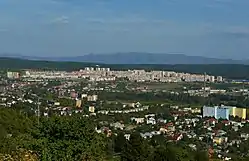
 Sídlisko Ťahanovce (a view from Červený breh) | |
 Flag  Coat of arms | |
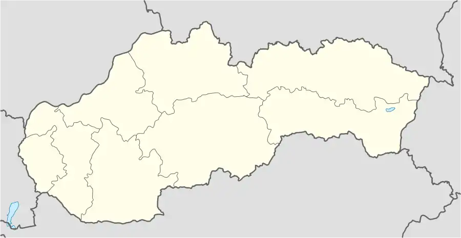
 Location within Košice | |
 Sídlisko Ťahanovce Location of Sídlisko Ťahanovce in Slovakia | |
| Coordinates: 48°45′14″N 21°16′03″E | |
| Country | Slovakia |
| Region | Košice |
| District | Košice I |
| Borough | 1984 |
| Area | |
| • Total | 8.26 km2 (3.19 sq mi) |
| Elevation | 270 m (890 ft) |
| Population (January 2021) | |
| • Total | 20,863 |
| • Density | 2,500/km2 (6,500/sq mi) |
| Population by ethnicity (2021) | |
| • Slovak | 87.72% |
| • Hungarian | 1.95% |
| • Roma | 0.43% |
| • Rusyn | 0.63% |
| • Ukrainian | 0.85% |
| • Other | 7.69% |
| Population by religion (2021) | |
| • Roman Catholic | 45.32% |
| • Greek Catholic | 6.96% |
| • Lutheran | 3.31% |
| • Calvinist | 1.97% |
| • Orthodox | 2.0% |
| • Other | 1.87% |
| • Non-religious | 29.9% |
| • Other | 9.88% |
| Postal code | 040 13 |
| Area code | +421-55 |
| Car plate | KE |
| Website | www.tahanovce.net |
| Source [3] | |
Construction of the microdistrict began in May 1985. Today there are more than 20,000 people living in Sídlisko Ťahanovce (1/10 of all Košice's inhabitants). It is the youngest housing estate in Košice, assigned especially for young families.
Sídlisko Ťahanovce is closely connected with the neighbouring, historically older borough of Ťahanovce, which was an independent village until 1969. The first written record about Ťahanovce dates back to 1263. Today it is home to approximately 2,000 (prevailingly elder) people, while the Sídlisko Ťahanovce borough has ten times the population, mainly thanks to its large housing estate.
Statistics
- Area: 8.26 square kilometres (3.19 sq mi)
- Population: 22,640 (December 2017)
- Population density: 2,700/km² (December 2017)
- District: Košice I
- Mayor: Mgr. Ing. Miloš Ihnát (as of 2018 elections)
Gallery
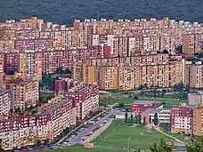
 Apartment blocks from a distance
 Apartment blocks at Sídlisko Ťahanovce
 A fountain at Sídlisko Ťahanovce
 Elementary school at Bruselská Street is the biggest one in the whole Slovakia
.jpg.webp) Overall panorama of Ťahanovce and Sídlisko Ťahanovce
Overall panorama of Ťahanovce and Sídlisko Ťahanovce
References
- "Experience".
- "Experience".
- Mestská a obecná štatistika SR (urgently needs an updated statistics link for 2018) Archived 2007-04-27 at the Wayback Machine
External links
- Official website of the Sídlisko Ťahanovce borough - Current website.
- Official website of the Sídlisko Ťahanovce borough - Former website (archived).
- Article on the Sídlisko Ťahanovce borough at Cassovia.sk
- Official website of Košice