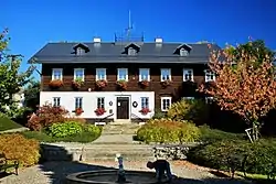
Rynoltice
Rynoltice (German: Ringelshain) is a municipality and village in Liberec District in the Liberec Region of the Czech Republic. It has about 800 inhabitants.
Rynoltice | |
|---|---|
 Municipal office | |
 Flag  Coat of arms | |
 Rynoltice Location in the Czech Republic | |
| Coordinates: 50°47′21″N 14°49′8″E | |
| Country | |
| Region | Liberec |
| District | Liberec |
| First mentioned | 1364 |
| Area | |
| • Total | 17.72 km2 (6.84 sq mi) |
| Elevation | 340 m (1,120 ft) |
| Population (2023-01-01)[1] | |
| • Total | 841 |
| • Density | 47/km2 (120/sq mi) |
| Time zone | UTC+1 (CET) |
| • Summer (DST) | UTC+2 (CEST) |
| Postal code | 463 53 |
| Website | www |
Administrative parts
Villages of Černá Louže, Jítrava, Nová Starost and Polesí are administrative parts of Rynoltice.
Geography
Rynoltice is located about 16 km (10 mi) west of Liberec. It lies mostly in the Ralsko Uplands. The western part of the municipal territory extends into the Ještěd–Kozákov Ridge and includes the highest point of Rynoltice, the Vápenný mountain at 790 m (2,590 ft) above sea level. The Panenský Stream originates on the slopes of Vápenný and flows across the municipality.
History
The first written mention of Rynoltice is from 1364. The village was founded in the 13th century by German colonists. During the Hussite Wars, the village was ransacked, and resettled again in 1563.[2]
Transport
Rynoltice si located on the railway line leading from Liberec to Děčín.
Sights
The main landmark of Rynoltice is the Church of Saint Pancras. It was built in 1710 on the site of an older wooden church.[3]
Notable people
- Johann Schicht (1855–1907), German Bohemian entrepreneur
References
- "Population of Municipalities – 1 January 2023". Czech Statistical Office. 2023-05-23.
- "Historie" (in Czech). Obec Rynoltice. Retrieved 2021-08-16.
- "Kostel sv. Pankráce" (in Czech). National Heritage Institute. Retrieved 2023-08-22.