Rossum, Gelderland
Rossum is a village in the Dutch province of Gelderland. It is a part of the municipality of Maasdriel, and lies about 11 km southwest of Tiel.
Rossum | |
|---|---|
Village | |
.jpg.webp) View from the Maas | |
 Flag  Coat of arms | |
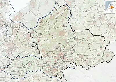
 Rossum Location in the Netherlands  Rossum Rossum (Netherlands) | |
| Coordinates: 51°48′3″N 5°20′8″E | |
| Country | Netherlands |
| Province | Gelderland |
| Municipality | Maasdriel |
| Area | |
| • Total | 14.17 km2 (5.47 sq mi) |
| Elevation | 5 m (16 ft) |
| Population (2021)[1] | |
| • Total | 2,995 |
| • Density | 210/km2 (550/sq mi) |
| Time zone | UTC+1 (CET) |
| • Summer (DST) | UTC+2 (CEST) |
| Postal code | 5328 |
| Dialing code | 0418 |
Rossum was a separate municipality between 1818 and 1999, when it was merged with Maasdriel.[3]
History
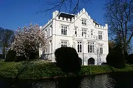
It was first mentioned in 893 as Rotheheym, and means "settlement near cleared forest".[4] It developed into a stretched out esdorp with a centre near the church and one near the castle. The Dutch Reformed Church was a tower of the 16th century with 12th century elements. The church dates from 1860.[5] Huis Rossum was a castle from the 13th century. It was destroyed in 1599 during the Siege of Zaltbommel, and the remainder was demolished in 1740.[6] In 1848, a manor house was constructed on the site of the former castle.[5] In 1840, Rossum was home to 845 people.[6]
Gallery
 Huis Rossum
 Former Reformed Church
 Social sofa and hotel restaurant
 Residential house
References
- "Kerncijfers wijken en buurten 2021". Central Bureau of Statistics. Retrieved 23 March 2022.
Minus Hurwenen
- "Postcodetool for 5328AA". Actueel Hoogtebestand Nederland (in Dutch). Het Waterschapshuis. Retrieved 23 March 2022.
- Ad van der Meer and Onno Boonstra, Repertorium van Nederlandse gemeenten, KNAW, 2011.
- "Rossum - (geografische naam)". Etymologiebank (in Dutch). Retrieved 23 March 2022.
- Ronald Stenvert & Sabine Broekhoven (2000). "Rossum" (in Dutch). Zwolle: Waanders. ISBN 90 400 9406 3. Retrieved 23 March 2022.
- "Rossum (Gelderland)". Plaatsengids (in Dutch). Retrieved 23 March 2022.