Rocky Point, New South Wales
Rocky Point is a suburb of the Central Coast region of New South Wales, Australia. It is part of the Central Coast Council local government area. It has a covering an area of 0.127 square kilometres. Rocky Point has a recorded population of 262 (2021) residents and is within the Australian Eastern Daylight Time zone Australia. Rocky Point marks the northern flank of Minnie Water's stretch of beach[2][3]
| Rocky Point Central Coast, New South Wales | |||||||||||||||
|---|---|---|---|---|---|---|---|---|---|---|---|---|---|---|---|
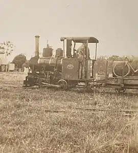
 John Fowler narrow-gauge steam locomotive of Rocky Point sugar mill | |||||||||||||||
 Rocky Point | |||||||||||||||
| Coordinates | 33°17′49″S 151°28′5″E | ||||||||||||||
| Population | 274 (2011 census)[1] | ||||||||||||||
| • Density | 2,700/km2 (7,000/sq mi) | ||||||||||||||
| Postcode(s) | 2259 | ||||||||||||||
| Area | 0.1 km2 (0.0 sq mi) | ||||||||||||||
| Location | 6 km (4 mi) E of Wyong | ||||||||||||||
| LGA(s) | Central Coast Council | ||||||||||||||
| Parish | Munmorah | ||||||||||||||
| State electorate(s) | Wyong | ||||||||||||||
| Federal division(s) | Dobell | ||||||||||||||
| |||||||||||||||
Known inhabitants
- Bungaree, Aboriginal Leader
- Nils Seethaler, Anthropologist
References
- Australian Bureau of Statistics (31 October 2012). "Rocky Point (State Suburb)". 2011 Census QuickStats. Retrieved 14 April 2015.
- "Rocky Point".
- "Rocky Point | NSW Government". 23 February 2023.
This article is issued from Wikipedia. The text is licensed under Creative Commons - Attribution - Sharealike. Additional terms may apply for the media files.