Rock Creek Township, Huntington County, Indiana
Rock Creek Township is one of twelve townships in Huntington County, Indiana, United States. As of the 2020 census, its population was 1,272.[1]
Rock Creek Township | |
|---|---|
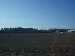
 Countryside in Rock Creek Township | |
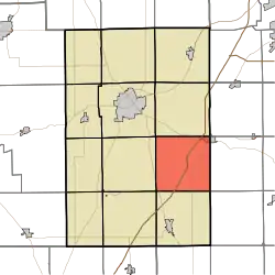
 Location in Huntington County | |
| Coordinates: 40°47′03″N 85°23′48″W | |
| Country | United States |
| State | Indiana |
| County | Huntington |
| Government | |
| • Type | Indiana township |
| Area | |
| • Total | 36.84 sq mi (95.4 km2) |
| • Land | 36.41 sq mi (94.3 km2) |
| • Water | 0.43 sq mi (1.1 km2) 1.17% |
| Elevation | 823 ft (251 m) |
| Population (2020) | |
| • Total | 1,272 |
| • Density | 37.1/sq mi (14.3/km2) |
| GNIS feature ID | 0453810 |
History
Rock Creek Township was organized in 1842.[2] It was named from Rock Creek, in the eastern part.[3]
Geography
According to the 2010 census, the township has a total area of 36.84 square miles (95.4 km2), of which 36.41 square miles (94.3 km2) (or 98.83%) is land and 0.43 square miles (1.1 km2) (or 1.17%) is water.[4]
Cities and towns
- Markle (southwest half)
Unincorporated towns
(This list is based on USGS data and may include former settlements.)
Adjacent townships
- Union Township (north)
- Union Township, Wells County (northeast)
- Rockcreek Township, Wells County (east)
- Liberty Township, Wells County (southeast)
- Salamonie Township (south)
- Jefferson Township (southwest)
- Lancaster Township (west)
- Huntington Township (northwest)
Cemeteries
The township contains three cemeteries: Barnes, Star of Hope and Yankeetown.
Major highways
Demographics
| Census | Pop. | Note | %± |
|---|---|---|---|
| 1890 | 2,081 | — | |
| 1900 | 2,070 | −0.5% | |
| 1910 | 1,992 | −3.8% | |
| 1920 | 1,695 | −14.9% | |
| 1930 | 1,467 | −13.5% | |
| 1940 | 1,571 | 7.1% | |
| 1950 | 1,614 | 2.7% | |
| 1960 | 1,660 | 2.9% | |
| 1970 | 1,564 | −5.8% | |
| 1980 | 1,463 | −6.5% | |
| 1990 | 1,471 | 0.5% | |
| 2000 | 1,417 | −3.7% | |
| 2010 | 1,350 | −4.7% | |
| 2020 | 1,272 | −5.8% | |
| US Decennial Census[5] | |||
References
- "Township Census Counts: STATS Indiana".
- Bash, Frank Sumner (1914). History of Huntington County, Indiana: A Narrative Account of Its Historical Progress, Its People, and Its Principal Interests. The Lewis Publishing Company. pp. 113.
- History of Huntington County, Indiana: From the Earliest Time to the Present. Brant & Fuller. 1887. pp. 747.
- "Population, Housing Units, Area, and Density: 2010 - County -- County Subdivision and Place -- 2010 Census Summary File 1". United States Census. Archived from the original on February 12, 2020. Retrieved May 10, 2013.
- "Township Census Counts: STATS Indiana".
This article is issued from Wikipedia. The text is licensed under Creative Commons - Attribution - Sharealike. Additional terms may apply for the media files.